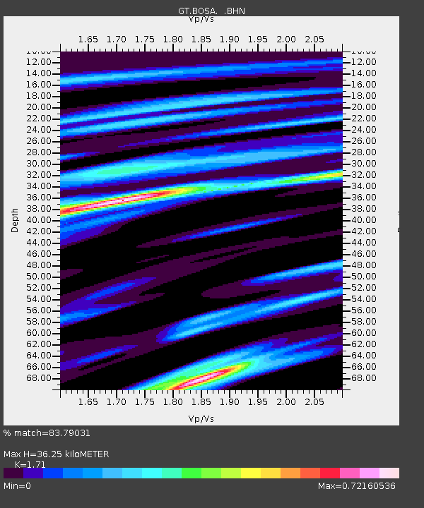
BOSA Boshof, South Africa - Earthquake Result Viewer
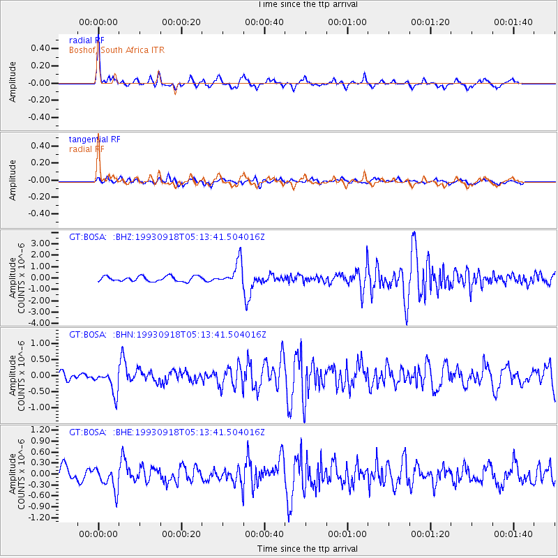
Earthquake location: Afghanistan-Tajikistan Bord Reg.
Earthquake latitude/longitude: 36.4/71.6
Earthquake time(UTC): 1993/09/18 (261) 05:02:27 GMT
Earthquake Depth: 117 km
Earthquake Magnitude: 6.1 MB, 6.4 UNKNOWN, 6.1 MW
Earthquake Catalog/Contributor: WHDF/NEIC
Network: GT Global Telemetered Seismograph Network (USAF/USGS)
Station: BOSA Boshof, South Africa
Lat/Lon: 28.61 S/25.26 E
Elevation: 1280 m
Distance: 78.0 deg
Az: 220.573 deg
Baz: 36.661 deg
Ray Param: 0.049691457
Estimated Moho Depth: 36.25 km
Estimated Crust Vp/Vs: 1.71
Assumed Crust Vp: 6.459 km/s
Estimated Crust Vs: 3.777 km/s
Estimated Crust Poisson's Ratio: 0.24
Radial Match: 83.79031 %
Radial Bump: 343
Transverse Match: 60.997017 %
Transverse Bump: 400
SOD ConfigId: 16938
Insert Time: 2010-02-27 01:43:32.199 +0000
GWidth: 2.5
Max Bumps: 400
Tol: 0.001

Signal To Noise

ChannelStoNSTALTA
GT:BOSA: :BHN:19930918T05:13:41.504016Z2.53950983.7028542E-71.458098E-7
GT:BOSA: :BHE:19930918T05:13:41.504016Z1.55267623.1800573E-72.0481137E-7
GT:BOSA: :BHZ:19930918T05:13:41.504016Z4.81917331.0757315E-62.2321909E-7
Arrivals
Ps4.1 SECOND
PpPs15 SECOND
PsPs/PpSs19 SECOND