You are here: Home > Network List > TA - USArray Transportable Network (new EarthScope stations) Stations List
> Station Q24A Divide, CO, USA > Earthquake Result Viewer
Q24A Divide, CO, USA - Earthquake Result Viewer
*The percent match for this event was below the threshold and hence no stack was calculated.
| Earthquake location: |
Santa Cruz Islands Region |
| Earthquake latitude/longitude: |
-11.7/164.9 |
| Earthquake time(UTC): |
2013/02/07 (038) 00:30:10 GMT |
| Earthquake Depth: |
8.0 km |
| Earthquake Magnitude: |
6.0 MB, 5.9 MS, 6.0 MW, 6.0 MW |
| Earthquake Catalog/Contributor: |
WHDF/NEIC |
|
| Network: |
TA USArray Transportable Network (new EarthScope stations) |
| Station: |
Q24A Divide, CO, USA |
| Lat/Lon: |
38.96 N/105.15 W |
| Elevation: |
2775 m |
|
| Distance: |
97.2 deg |
| Az: |
51.787 deg |
| Baz: |
260.868 deg |
| Ray Param: |
$rayparam |
*The percent match for this event was below the threshold and hence was not used in the summary stack. |
|
| Radial Match: |
45.029316 % |
| Radial Bump: |
400 |
| Transverse Match: |
59.69561 % |
| Transverse Bump: |
400 |
| SOD ConfigId: |
494114 |
| Insert Time: |
2013-05-01 08:22:35.308 +0000 |
| GWidth: |
2.5 |
| Max Bumps: |
400 |
| Tol: |
0.001 |
|
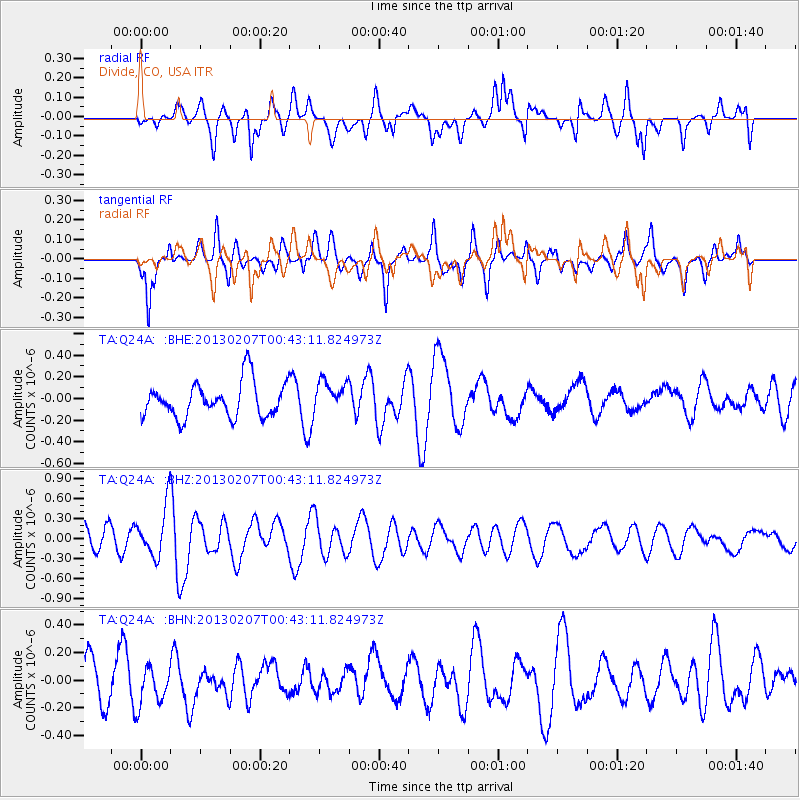
Signal To Noise
| Channel | StoN | STA | LTA |
| TA:Q24A: :BHZ:20130207T00:43:11.824973Z | 1.850788 | 3.7605176E-7 | 2.0318468E-7 |
| TA:Q24A: :BHN:20130207T00:43:11.824973Z | 0.79195535 | 1.4465701E-7 | 1.8265804E-7 |
| TA:Q24A: :BHE:20130207T00:43:11.824973Z | 0.9105864 | 1.4748137E-7 | 1.6196307E-7 |
| Arrivals |
| Ps | |
| PpPs | |
| PsPs/PpSs | |


