BOSA Boshof, South Africa - Earthquake Result Viewer
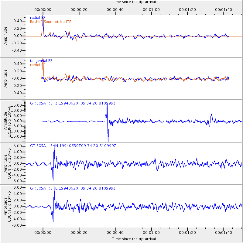
Earthquake location: Afghanistan-Tajikistan Bord Reg.
Earthquake latitude/longitude: 36.3/71.1
Earthquake time(UTC): 1994/06/30 (181) 09:23:21 GMT
Earthquake Depth: 233 km
Earthquake Magnitude: 6.1 MB, 6.4 UNKNOWN, 6.2 MW
Earthquake Catalog/Contributor: WHDF/NEIC
Network: GT Global Telemetered Seismograph Network (USAF/USGS)
Station: BOSA Boshof, South Africa
Lat/Lon: 28.61 S/25.26 E
Elevation: 1280 m
Distance: 77.6 deg
Az: 220.215 deg
Baz: 36.412 deg
Ray Param: 0.049601402
Estimated Moho Depth: 30.75 km
Estimated Crust Vp/Vs: 1.77
Assumed Crust Vp: 6.459 km/s
Estimated Crust Vs: 3.639 km/s
Estimated Crust Poisson's Ratio: 0.27
Radial Match: 87.74244 %
Radial Bump: 365
Transverse Match: 64.57878 %
Transverse Bump: 400
SOD ConfigId: 16938
Insert Time: 2010-02-27 01:43:40.003 +0000
GWidth: 2.5
Max Bumps: 400
Tol: 0.001

Signal To Noise

ChannelStoNSTALTA
GT:BOSA: :BHN:19940630T09:34:20.810999Z2.27017785.2810117E-72.3262547E-7
GT:BOSA: :BHE:19940630T09:34:20.810999Z1.61326555.765309E-73.5736886E-7
GT:BOSA: :BHZ:19940630T09:34:20.810999Z4.29037671.668229E-63.8883041E-7
Arrivals
Ps3.8 SECOND
PpPs13 SECOND
PsPs/PpSs17 SECOND