You are here: Home > Network List > UW - Pacific Northwest Regional Seismic Network Stations List
> Station MRBL Marblemount, WA, USA > Earthquake Result Viewer
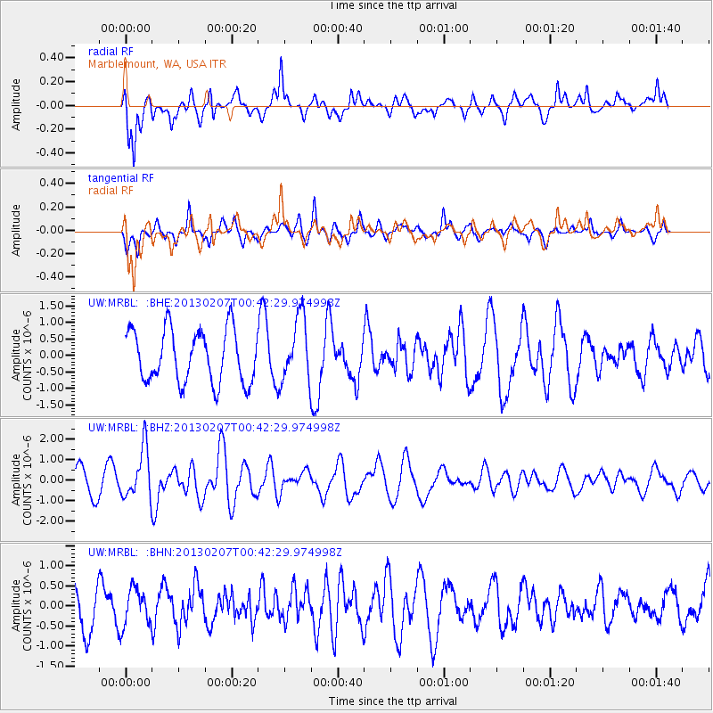
MRBL Marblemount, WA, USA - Earthquake Result Viewer
*The percent match for this event was below the threshold and hence no stack was calculated.
| Earthquake location: |
Santa Cruz Islands Region |
| Earthquake latitude/longitude: |
-11.7/164.9 |
| Earthquake time(UTC): |
2013/02/07 (038) 00:30:10 GMT |
| Earthquake Depth: |
8.0 km |
| Earthquake Magnitude: |
6.0 MB, 5.9 MS, 6.0 MW, 6.0 MW |
| Earthquake Catalog/Contributor: |
WHDF/NEIC |
|
| Network: |
UW Pacific Northwest Regional Seismic Network |
| Station: |
MRBL Marblemount, WA, USA |
| Lat/Lon: |
48.52 N/121.48 W |
| Elevation: |
75 m |
|
| Distance: |
88.0 deg |
| Az: |
39.652 deg |
| Baz: |
250.087 deg |
| Ray Param: |
$rayparam |
*The percent match for this event was below the threshold and hence was not used in the summary stack. |
|
| Radial Match: |
64.803185 % |
| Radial Bump: |
400 |
| Transverse Match: |
66.38236 % |
| Transverse Bump: |
400 |
| SOD ConfigId: |
494114 |
| Insert Time: |
2013-05-01 08:28:48.668 +0000 |
| GWidth: |
2.5 |
| Max Bumps: |
400 |
| Tol: |
0.001 |
|
Signal To Noise
| Channel | StoN | STA | LTA |
| UW:MRBL: :BHZ:20130207T00:42:29.974998Z | 2.388124 | 1.2320226E-6 | 5.158956E-7 |
| UW:MRBL: :BHN:20130207T00:42:29.974998Z | 0.84959286 | 4.5667483E-7 | 5.37522E-7 |
| UW:MRBL: :BHE:20130207T00:42:29.974998Z | 1.2268028 | 9.778939E-7 | 7.9710765E-7 |
| Arrivals |
| Ps | |
| PpPs | |
| PsPs/PpSs | |


