You are here: Home > Network List > GS - US Geological Survey Networks Stations List
> Station KAN10 Keim Farm > Earthquake Result Viewer
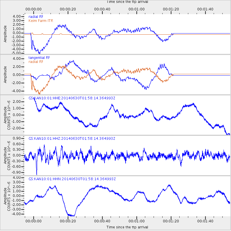
KAN10 Keim Farm - Earthquake Result Viewer
*The percent match for this event was below the threshold and hence no stack was calculated.
| Earthquake location: |
North Of Ascension Island |
| Earthquake latitude/longitude: |
0.0/-17.3 |
| Earthquake time(UTC): |
2014/06/30 (181) 01:46:23 GMT |
| Earthquake Depth: |
8.0 km |
| Earthquake Magnitude: |
5.8 MB |
| Earthquake Catalog/Contributor: |
NEIC PDE/NEIC COMCAT |
|
| Network: |
GS US Geological Survey Networks |
| Station: |
KAN10 Keim Farm |
| Lat/Lon: |
37.12 N/98.10 W |
| Elevation: |
417 m |
|
| Distance: |
82.6 deg |
| Az: |
307.295 deg |
| Baz: |
95.558 deg |
| Ray Param: |
$rayparam |
*The percent match for this event was below the threshold and hence was not used in the summary stack. |
|
| Radial Match: |
72.62167 % |
| Radial Bump: |
400 |
| Transverse Match: |
32.58842 % |
| Transverse Bump: |
366 |
| SOD ConfigId: |
3390531 |
| Insert Time: |
2019-04-12 15:06:14.973 +0000 |
| GWidth: |
2.5 |
| Max Bumps: |
400 |
| Tol: |
0.001 |
|
Signal To Noise
| Channel | StoN | STA | LTA |
| GS:KAN10:01:HHZ:20140630T01:58:14.364993Z | 2.6721015 | 2.9159915E-7 | 1.0912728E-7 |
| GS:KAN10:01:HHN:20140630T01:58:14.364993Z | 0.81479526 | 1.205436E-6 | 1.4794341E-6 |
| GS:KAN10:01:HHE:20140630T01:58:14.364993Z | 3.755855 | 2.4878148E-6 | 6.6238306E-7 |
| Arrivals |
| Ps | |
| PpPs | |
| PsPs/PpSs | |


