You are here: Home > Network List > TA - USArray Transportable Network (new EarthScope stations) Stations List
> Station G05D Wamic, OR, USA > Earthquake Result Viewer
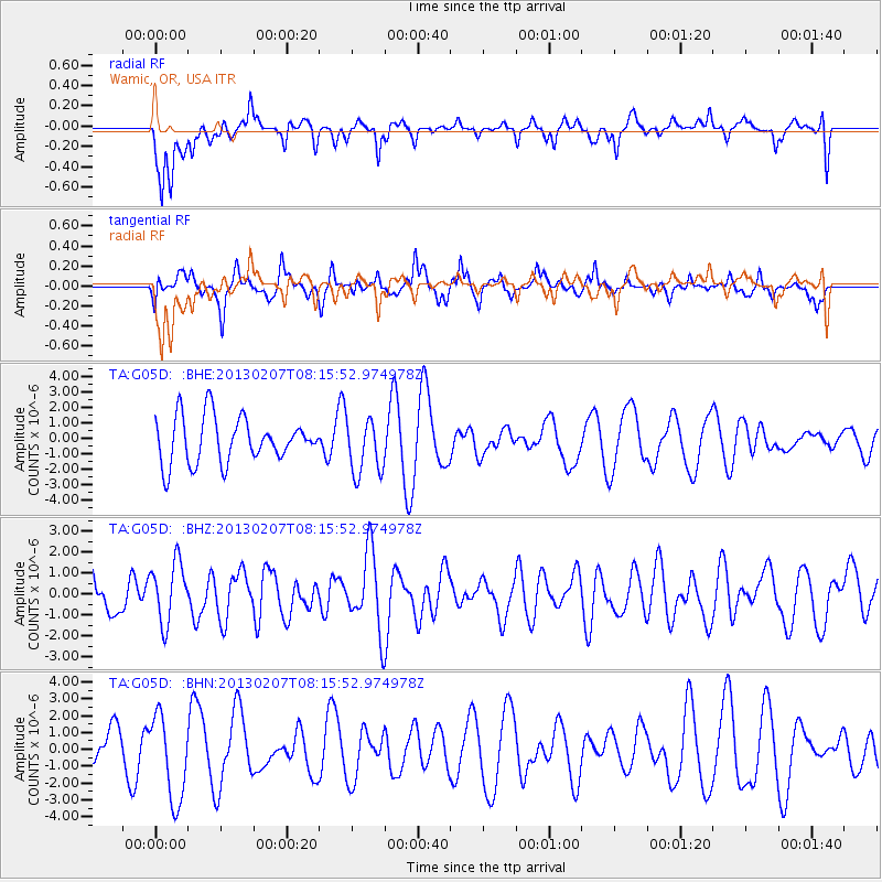
G05D Wamic, OR, USA - Earthquake Result Viewer
*The percent match for this event was below the threshold and hence no stack was calculated.
| Earthquake location: |
Santa Cruz Islands Region |
| Earthquake latitude/longitude: |
-11.0/164.8 |
| Earthquake time(UTC): |
2013/02/07 (038) 08:03:40 GMT |
| Earthquake Depth: |
11 km |
| Earthquake Magnitude: |
5.5 MB, 5.4 MS, 5.8 MW, 5.8 MW |
| Earthquake Catalog/Contributor: |
WHDF/NEIC |
|
| Network: |
TA USArray Transportable Network (new EarthScope stations) |
| Station: |
G05D Wamic, OR, USA |
| Lat/Lon: |
45.24 N/121.32 W |
| Elevation: |
592 m |
|
| Distance: |
86.7 deg |
| Az: |
42.839 deg |
| Baz: |
250.885 deg |
| Ray Param: |
$rayparam |
*The percent match for this event was below the threshold and hence was not used in the summary stack. |
|
| Radial Match: |
51.845356 % |
| Radial Bump: |
400 |
| Transverse Match: |
46.980927 % |
| Transverse Bump: |
400 |
| SOD ConfigId: |
494114 |
| Insert Time: |
2013-05-01 08:36:16.111 +0000 |
| GWidth: |
2.5 |
| Max Bumps: |
400 |
| Tol: |
0.001 |
|
Signal To Noise
| Channel | StoN | STA | LTA |
| TA:G05D: :BHZ:20130207T08:15:52.974978Z | 1.4358213 | 1.4430509E-6 | 1.0050352E-6 |
| TA:G05D: :BHN:20130207T08:15:52.974978Z | 2.4747167 | 2.5383756E-6 | 1.0257237E-6 |
| TA:G05D: :BHE:20130207T08:15:52.974978Z | 1.2143191 | 1.7851673E-6 | 1.4700975E-6 |
| Arrivals |
| Ps | |
| PpPs | |
| PsPs/PpSs | |


