BOSA Boshof, South Africa - Earthquake Result Viewer
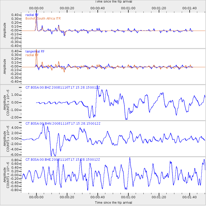
Earthquake location: Minahassa Peninsula, Sulawesi
Earthquake latitude/longitude: 1.3/122.1
Earthquake time(UTC): 2008/11/16 (321) 17:02:32 GMT
Earthquake Depth: 30 km
Earthquake Magnitude: 6.5 MB, 7.0 MS, 7.3 MW, 7.3 MW
Earthquake Catalog/Contributor: WHDF/NEIC
Network: GT Global Telemetered Seismograph Network (USAF/USGS)
Station: BOSA Boshof, South Africa
Lat/Lon: 28.61 S/25.26 E
Elevation: 1280 m
Distance: 96.6 deg
Az: 241.498 deg
Baz: 92.153 deg
Ray Param: 0.040449865
Estimated Moho Depth: 36.0 km
Estimated Crust Vp/Vs: 1.67
Assumed Crust Vp: 6.459 km/s
Estimated Crust Vs: 3.874 km/s
Estimated Crust Poisson's Ratio: 0.22
Radial Match: 94.095924 %
Radial Bump: 206
Transverse Match: 83.31204 %
Transverse Bump: 400
SOD ConfigId: 2658
Insert Time: 2010-02-27 01:44:02.572 +0000
GWidth: 2.5
Max Bumps: 400
Tol: 0.001

Signal To Noise

ChannelStoNSTALTA
GT:BOSA:00:BHN:20081116T17:15:28.150012Z14.571642.5089298E-61.7217897E-7
GT:BOSA:00:BHE:20081116T17:15:28.150012Z1.56566562.197224E-71.4033802E-7
GT:BOSA:00:BHZ:20081116T17:15:28.150012Z8.6828347.904881E-79.1040334E-8
Arrivals
Ps3.8 SECOND
PpPs15 SECOND
PsPs/PpSs18 SECOND