You are here: Home > Network List > TA - USArray Transportable Network (new EarthScope stations) Stations List
> Station O03E Paynes Creek, CA, USA > Earthquake Result Viewer
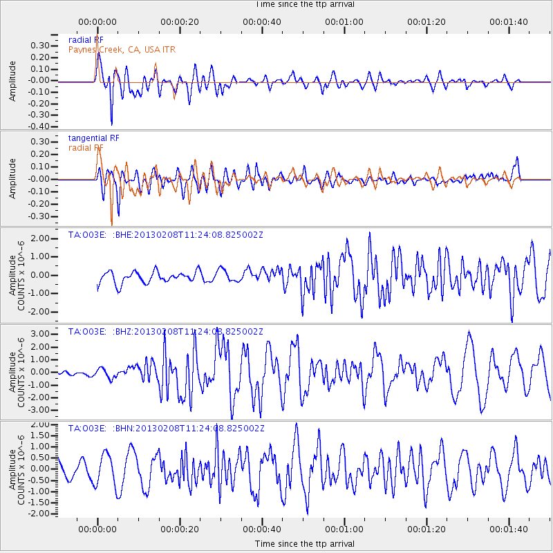
O03E Paynes Creek, CA, USA - Earthquake Result Viewer
*The percent match for this event was below the threshold and hence no stack was calculated.
| Earthquake location: |
Santa Cruz Islands |
| Earthquake latitude/longitude: |
-10.8/166.0 |
| Earthquake time(UTC): |
2013/02/08 (039) 11:12:11 GMT |
| Earthquake Depth: |
12 km |
| Earthquake Magnitude: |
6.3 MB, 6.9 MS, 6.8 MW, 6.8 MW |
| Earthquake Catalog/Contributor: |
WHDF/NEIC |
|
| Network: |
TA USArray Transportable Network (new EarthScope stations) |
| Station: |
O03E Paynes Creek, CA, USA |
| Lat/Lon: |
40.29 N/121.80 W |
| Elevation: |
967 m |
|
| Distance: |
83.7 deg |
| Az: |
47.116 deg |
| Baz: |
250.241 deg |
| Ray Param: |
$rayparam |
*The percent match for this event was below the threshold and hence was not used in the summary stack. |
|
| Radial Match: |
85.38502 % |
| Radial Bump: |
400 |
| Transverse Match: |
67.4722 % |
| Transverse Bump: |
400 |
| SOD ConfigId: |
494114 |
| Insert Time: |
2013-05-01 08:51:55.856 +0000 |
| GWidth: |
2.5 |
| Max Bumps: |
400 |
| Tol: |
0.001 |
|
Signal To Noise
| Channel | StoN | STA | LTA |
| TA:O03E: :BHZ:20130208T11:24:08.825002Z | 1.9791112 | 3.708499E-7 | 1.8738206E-7 |
| TA:O03E: :BHN:20130208T11:24:08.825002Z | 1.8201743 | 7.151338E-7 | 3.9289304E-7 |
| TA:O03E: :BHE:20130208T11:24:08.825002Z | 1.0936613 | 3.4059187E-7 | 3.1142355E-7 |
| Arrivals |
| Ps | |
| PpPs | |
| PsPs/PpSs | |


