
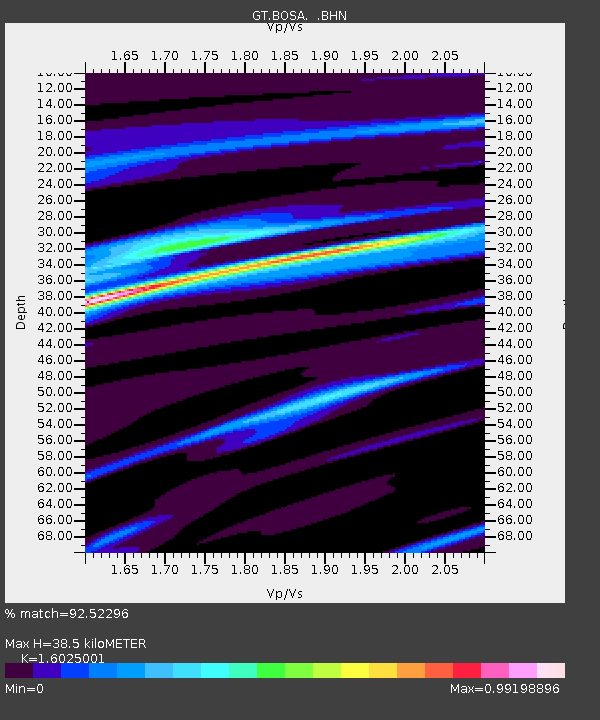
BOSA Boshof, South Africa - Earthquake Result Viewer
| ||||||||||||||||||
| ||||||||||||||||||
| ||||||||||||||||||
|
Signal To Noise
| Channel | StoN | STA | LTA |
| GT:BOSA: :BHN:20010213T19:39:46.335012Z | 1.1616911 | 3.172446E-7 | 2.730886E-7 |
| GT:BOSA: :BHE:20010213T19:39:46.335012Z | 2.3875062 | 4.6758512E-7 | 1.9584665E-7 |
| GT:BOSA: :BHZ:20010213T19:39:46.335012Z | 1.4887937 | 5.524158E-7 | 3.7104928E-7 |
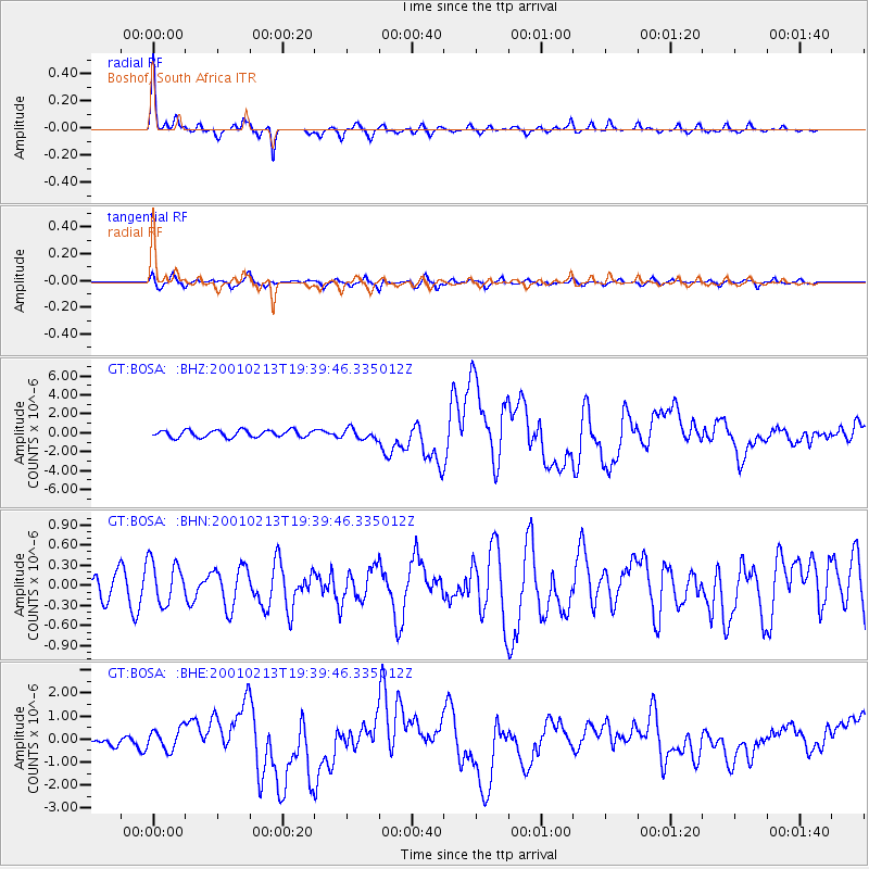
| Arrivals | |
| Ps | 3.7 SECOND |
| PpPs | 15 SECOND |
| PsPs/PpSs | 19 SECOND |

