
BOSA Boshof, South Africa - Earthquake Result Viewer
| ||||||||||||||||||
| ||||||||||||||||||
| ||||||||||||||||||
|
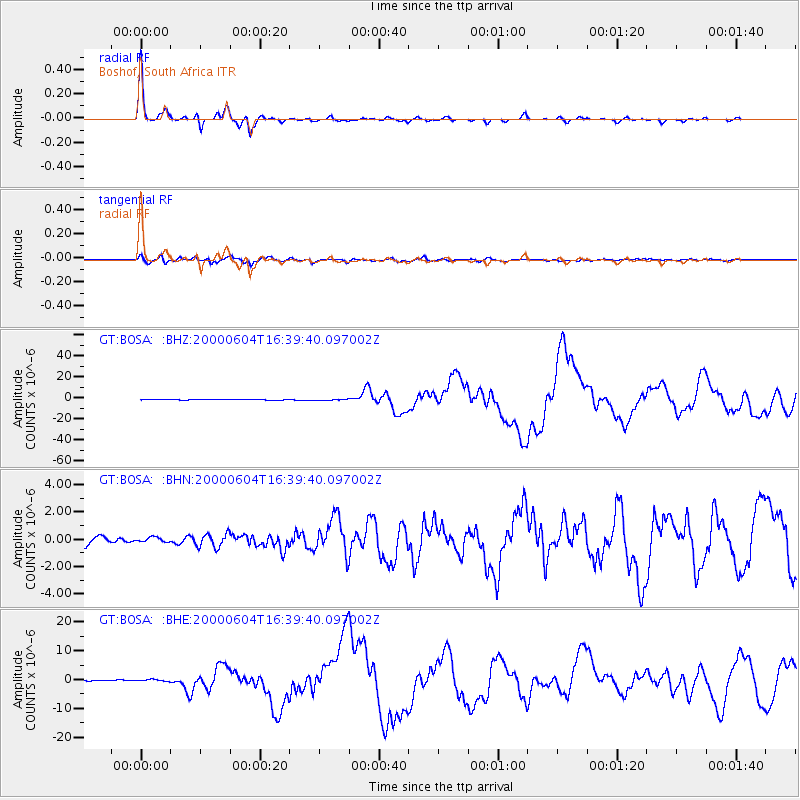
Signal To Noise
| Channel | StoN | STA | LTA |
| GT:BOSA: :BHN:20000604T16:39:40.097002Z | 0.7492671 | 1.7571406E-7 | 2.3451459E-7 |
| GT:BOSA: :BHE:20000604T16:39:40.097002Z | 2.4518876 | 3.5866765E-7 | 1.4628225E-7 |
| GT:BOSA: :BHZ:20000604T16:39:40.097002Z | 2.0745652 | 5.2076996E-7 | 2.5102608E-7 |
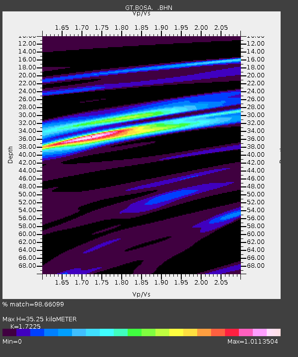
| Arrivals | |
| Ps | 4.1 SECOND |
| PpPs | 14 SECOND |
| PsPs/PpSs | 18 SECOND |

