You are here: Home > Network List > TA - USArray Transportable Network (new EarthScope stations) Stations List
> Station A04D Lummi Island, WA, USA > Earthquake Result Viewer
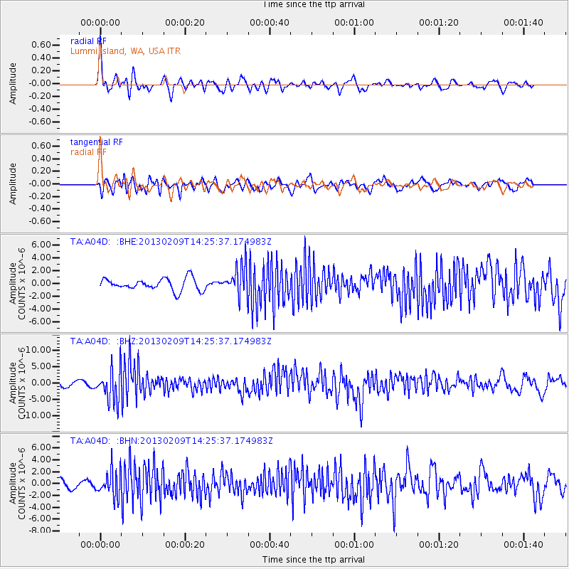
A04D Lummi Island, WA, USA - Earthquake Result Viewer
*The percent match for this event was below the threshold and hence no stack was calculated.
| Earthquake location: |
Colombia |
| Earthquake latitude/longitude: |
1.1/-77.4 |
| Earthquake time(UTC): |
2013/02/09 (040) 14:16:07 GMT |
| Earthquake Depth: |
145 km |
| Earthquake Magnitude: |
6.7 MB, 6.9 MW, 6.9 MW |
| Earthquake Catalog/Contributor: |
WHDF/NEIC |
|
| Network: |
TA USArray Transportable Network (new EarthScope stations) |
| Station: |
A04D Lummi Island, WA, USA |
| Lat/Lon: |
48.72 N/122.71 W |
| Elevation: |
13 m |
|
| Distance: |
61.3 deg |
| Az: |
327.533 deg |
| Baz: |
125.86 deg |
| Ray Param: |
$rayparam |
*The percent match for this event was below the threshold and hence was not used in the summary stack. |
|
| Radial Match: |
76.523605 % |
| Radial Bump: |
400 |
| Transverse Match: |
68.871284 % |
| Transverse Bump: |
400 |
| SOD ConfigId: |
494114 |
| Insert Time: |
2013-05-01 09:35:48.892 +0000 |
| GWidth: |
2.5 |
| Max Bumps: |
400 |
| Tol: |
0.001 |
|
Signal To Noise
| Channel | StoN | STA | LTA |
| TA:A04D: :BHZ:20130209T14:25:37.174983Z | 5.7763977 | 5.016739E-6 | 8.684892E-7 |
| TA:A04D: :BHN:20130209T14:25:37.174983Z | 2.6302605 | 2.2255092E-6 | 8.461175E-7 |
| TA:A04D: :BHE:20130209T14:25:37.174983Z | 2.5003834 | 2.3358016E-6 | 9.341773E-7 |
| Arrivals |
| Ps | |
| PpPs | |
| PsPs/PpSs | |


