You are here: Home > Network List > TA - USArray Transportable Network (new EarthScope stations) Stations List
> Station M42A Sheffield, IL, USA > Earthquake Result Viewer
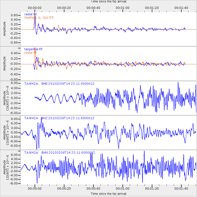
M42A Sheffield, IL, USA - Earthquake Result Viewer
*The percent match for this event was below the threshold and hence no stack was calculated.
| Earthquake location: |
Colombia |
| Earthquake latitude/longitude: |
1.1/-77.4 |
| Earthquake time(UTC): |
2013/02/09 (040) 14:16:07 GMT |
| Earthquake Depth: |
145 km |
| Earthquake Magnitude: |
6.7 MB, 6.9 MW, 6.9 MW |
| Earthquake Catalog/Contributor: |
WHDF/NEIC |
|
| Network: |
TA USArray Transportable Network (new EarthScope stations) |
| Station: |
M42A Sheffield, IL, USA |
| Lat/Lon: |
41.45 N/89.76 W |
| Elevation: |
212 m |
|
| Distance: |
41.7 deg |
| Az: |
345.987 deg |
| Baz: |
161.211 deg |
| Ray Param: |
$rayparam |
*The percent match for this event was below the threshold and hence was not used in the summary stack. |
|
| Radial Match: |
69.08609 % |
| Radial Bump: |
400 |
| Transverse Match: |
67.45748 % |
| Transverse Bump: |
400 |
| SOD ConfigId: |
494114 |
| Insert Time: |
2013-05-01 09:40:44.456 +0000 |
| GWidth: |
2.5 |
| Max Bumps: |
400 |
| Tol: |
0.001 |
|
Signal To Noise
| Channel | StoN | STA | LTA |
| TA:M42A: :BHZ:20130209T14:23:11.600001Z | 8.290889 | 5.7987545E-6 | 6.9941296E-7 |
| TA:M42A: :BHN:20130209T14:23:11.600001Z | 3.6555986 | 2.9365308E-6 | 8.032968E-7 |
| TA:M42A: :BHE:20130209T14:23:11.600001Z | 1.4497768 | 1.3836359E-6 | 9.543785E-7 |
| Arrivals |
| Ps | |
| PpPs | |
| PsPs/PpSs | |


