You are here: Home > Network List > TA - USArray Transportable Network (new EarthScope stations) Stations List
> Station P47A Martinsville, IN, USA > Earthquake Result Viewer
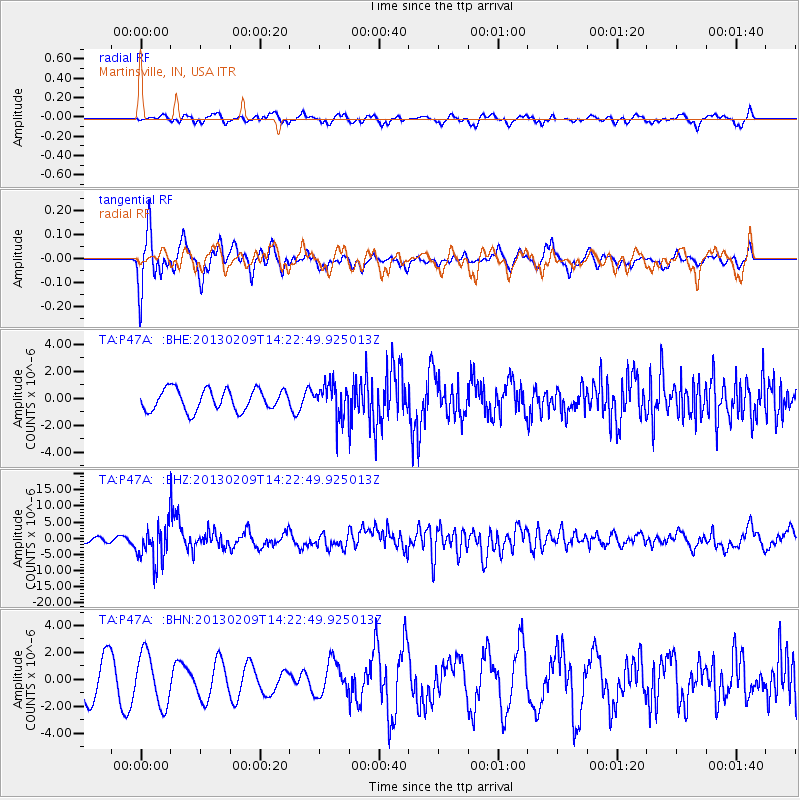
P47A Martinsville, IN, USA - Earthquake Result Viewer
*The percent match for this event was below the threshold and hence no stack was calculated.
| Earthquake location: |
Colombia |
| Earthquake latitude/longitude: |
1.1/-77.4 |
| Earthquake time(UTC): |
2013/02/09 (040) 14:16:07 GMT |
| Earthquake Depth: |
145 km |
| Earthquake Magnitude: |
6.7 MB, 6.9 MW, 6.9 MW |
| Earthquake Catalog/Contributor: |
WHDF/NEIC |
|
| Network: |
TA USArray Transportable Network (new EarthScope stations) |
| Station: |
P47A Martinsville, IN, USA |
| Lat/Lon: |
39.49 N/86.27 W |
| Elevation: |
246 m |
|
| Distance: |
39.0 deg |
| Az: |
349.068 deg |
| Baz: |
165.817 deg |
| Ray Param: |
$rayparam |
*The percent match for this event was below the threshold and hence was not used in the summary stack. |
|
| Radial Match: |
48.385628 % |
| Radial Bump: |
400 |
| Transverse Match: |
73.63626 % |
| Transverse Bump: |
400 |
| SOD ConfigId: |
494114 |
| Insert Time: |
2013-05-01 09:45:54.804 +0000 |
| GWidth: |
2.5 |
| Max Bumps: |
400 |
| Tol: |
0.001 |
|
Signal To Noise
| Channel | StoN | STA | LTA |
| TA:P47A: :BHZ:20130209T14:22:49.925013Z | 5.5423393 | 5.7196294E-6 | 1.0319883E-6 |
| TA:P47A: :BHN:20130209T14:22:49.925013Z | 1.1892375 | 1.9030697E-6 | 1.6002435E-6 |
| TA:P47A: :BHE:20130209T14:22:49.925013Z | 1.5698522 | 1.2254155E-6 | 7.805929E-7 |
| Arrivals |
| Ps | |
| PpPs | |
| PsPs/PpSs | |


