
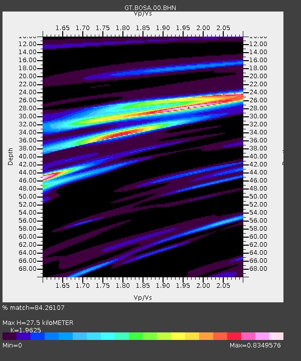
BOSA Boshof, South Africa - Earthquake Result Viewer
| ||||||||||||||||||
| ||||||||||||||||||
| ||||||||||||||||||
|
Signal To Noise
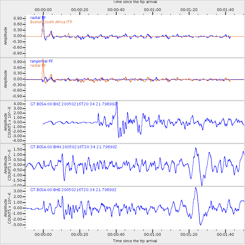
| Channel | StoN | STA | LTA |
| GT:BOSA:00:BHN:20050216T20:34:21.79899Z | 1.5756987 | 2.2347447E-7 | 1.4182564E-7 |
| GT:BOSA:00:BHE:20050216T20:34:21.79899Z | 2.3374834 | 5.4847607E-7 | 2.3464382E-7 |
| GT:BOSA:00:BHZ:20050216T20:34:21.79899Z | 4.4034367 | 7.4614684E-7 | 1.6944648E-7 |
| Arrivals | |
| Ps | 4.4 SECOND |
| PpPs | 12 SECOND |
| PsPs/PpSs | 16 SECOND |

