You are here: Home > Network List > KN - Kyrgyz Seismic Telemetry Network Stations List
> Station TKM2 - > Earthquake Result Viewer
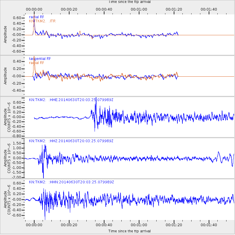
TKM2 - - Earthquake Result Viewer
*The percent match for this event was below the threshold and hence no stack was calculated.
| Earthquake location: |
Bonin Islands, Japan Region |
| Earthquake latitude/longitude: |
28.4/138.9 |
| Earthquake time(UTC): |
2014/06/30 (181) 19:55:32 GMT |
| Earthquake Depth: |
512 km |
| Earthquake Magnitude: |
6.2 MWB |
| Earthquake Catalog/Contributor: |
NEIC PDE/NEIC COMCAT |
|
| Network: |
KN Kyrgyz Seismic Telemetry Network |
| Station: |
TKM2 - |
| Lat/Lon: |
42.92 N/75.60 E |
| Elevation: |
2020 m |
|
| Distance: |
52.3 deg |
| Az: |
303.964 deg |
| Baz: |
84.339 deg |
| Ray Param: |
$rayparam |
*The percent match for this event was below the threshold and hence was not used in the summary stack. |
|
| Radial Match: |
75.1995 % |
| Radial Bump: |
400 |
| Transverse Match: |
60.09584 % |
| Transverse Bump: |
400 |
| SOD ConfigId: |
3390531 |
| Insert Time: |
2019-04-12 15:21:09.052 +0000 |
| GWidth: |
2.5 |
| Max Bumps: |
400 |
| Tol: |
0.001 |
|
Signal To Noise
| Channel | StoN | STA | LTA |
| KN:TKM2: :HHZ:20140630T20:03:25.079989Z | 11.128143 | 3.758641E-7 | 3.377599E-8 |
| KN:TKM2: :HHN:20140630T20:03:25.079989Z | 2.4283345 | 8.683928E-8 | 3.576084E-8 |
| KN:TKM2: :HHE:20140630T20:03:25.079989Z | 6.538898 | 1.54816E-7 | 2.367616E-8 |
| Arrivals |
| Ps | |
| PpPs | |
| PsPs/PpSs | |


