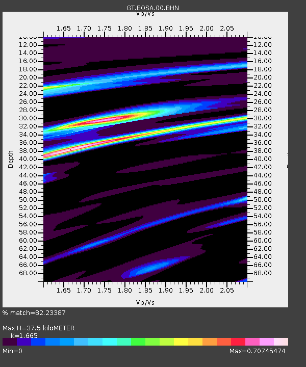
BOSA Boshof, South Africa - Earthquake Result Viewer
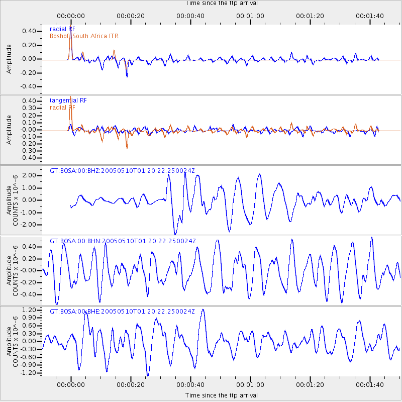
Earthquake location: Southwest Of Sumatra, Indonesia
Earthquake latitude/longitude: -6.2/103.1
Earthquake time(UTC): 2005/05/10 (130) 01:09:05 GMT
Earthquake Depth: 17 km
Earthquake Magnitude: 5.9 MB, 6.4 MS, 6.2 MW, 6.2 MW
Earthquake Catalog/Contributor: WHDF/NEIC
Network: GT Global Telemetered Seismograph Network (USAF/USGS)
Station: BOSA Boshof, South Africa
Lat/Lon: 28.61 S/25.26 E
Elevation: 1280 m
Distance: 76.4 deg
Az: 242.171 deg
Baz: 89.723 deg
Ray Param: 0.050993096
Estimated Moho Depth: 37.5 km
Estimated Crust Vp/Vs: 1.66
Assumed Crust Vp: 6.459 km/s
Estimated Crust Vs: 3.88 km/s
Estimated Crust Poisson's Ratio: 0.22
Radial Match: 82.23387 %
Radial Bump: 350
Transverse Match: 65.059685 %
Transverse Bump: 400
SOD ConfigId: 2455
Insert Time: 2010-02-27 01:45:38.736 +0000
GWidth: 2.5
Max Bumps: 400
Tol: 0.001

Signal To Noise

ChannelStoNSTALTA
GT:BOSA:00:BHN:20050510T01:20:22.250024Z0.797590431.833363E-72.2986272E-7
GT:BOSA:00:BHE:20050510T01:20:22.250024Z1.98280475.607848E-72.8282406E-7
GT:BOSA:00:BHZ:20050510T01:20:22.250024Z4.70013861.2003286E-62.5538154E-7
Arrivals
Ps4.0 SECOND
PpPs15 SECOND
PsPs/PpSs19 SECOND