You are here: Home > Network List > GT - Global Telemetered Seismograph Network (USAF/USGS) Stations List
> Station BOSA Boshof, South Africa > Earthquake Result Viewer
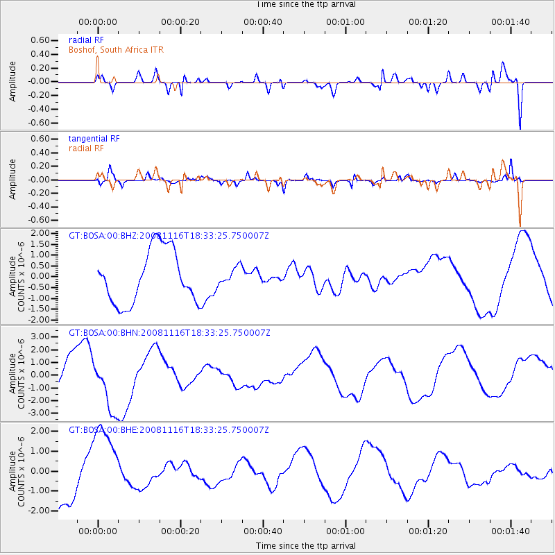
BOSA Boshof, South Africa - Earthquake Result Viewer
*The percent match for this event was below the threshold and hence no stack was calculated.
| Earthquake location: |
Minahassa Peninsula, Sulawesi |
| Earthquake latitude/longitude: |
1.1/121.8 |
| Earthquake time(UTC): |
2008/11/16 (321) 18:20:32 GMT |
| Earthquake Depth: |
35 km |
| Earthquake Magnitude: |
5.5 MB |
| Earthquake Catalog/Contributor: |
WHDF/NEIC |
|
| Network: |
GT Global Telemetered Seismograph Network (USAF/USGS) |
| Station: |
BOSA Boshof, South Africa |
| Lat/Lon: |
28.61 S/25.26 E |
| Elevation: |
1280 m |
|
| Distance: |
96.3 deg |
| Az: |
241.495 deg |
| Baz: |
92.128 deg |
| Ray Param: |
$rayparam |
*The percent match for this event was below the threshold and hence was not used in the summary stack. |
|
| Radial Match: |
63.18615 % |
| Radial Bump: |
400 |
| Transverse Match: |
43.088818 % |
| Transverse Bump: |
400 |
| SOD ConfigId: |
2658 |
| Insert Time: |
2010-02-27 01:46:05.138 +0000 |
| GWidth: |
2.5 |
| Max Bumps: |
400 |
| Tol: |
0.001 |
|
Signal To Noise
| Channel | StoN | STA | LTA |
| GT:BOSA:00:BHN:20081116T18:33:25.750007Z | 2.3081877 | 2.1369092E-6 | 9.2579523E-7 |
| GT:BOSA:00:BHE:20081116T18:33:25.750007Z | 2.3216603 | 2.0538832E-6 | 8.8466135E-7 |
| GT:BOSA:00:BHZ:20081116T18:33:25.750007Z | 0.32759568 | 3.9960952E-7 | 1.2198254E-6 |
| Arrivals |
| Ps | |
| PpPs | |
| PsPs/PpSs | |


