You are here: Home > Network List > UW - Pacific Northwest Regional Seismic Network Stations List
> Station MRBL Marblemount, WA, USA > Earthquake Result Viewer
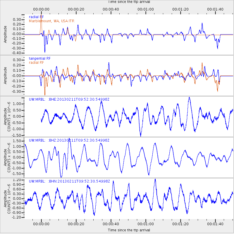
MRBL Marblemount, WA, USA - Earthquake Result Viewer
*The percent match for this event was below the threshold and hence no stack was calculated.
| Earthquake location: |
Santa Cruz Islands |
| Earthquake latitude/longitude: |
-11.0/166.8 |
| Earthquake time(UTC): |
2013/02/11 (042) 09:40:19 GMT |
| Earthquake Depth: |
10 km |
| Earthquake Magnitude: |
5.7 MB, 5.6 MS, 5.7 MW, 5.6 MW |
| Earthquake Catalog/Contributor: |
WHDF/NEIC |
|
| Network: |
UW Pacific Northwest Regional Seismic Network |
| Station: |
MRBL Marblemount, WA, USA |
| Lat/Lon: |
48.52 N/121.48 W |
| Elevation: |
75 m |
|
| Distance: |
86.4 deg |
| Az: |
39.238 deg |
| Baz: |
249.064 deg |
| Ray Param: |
$rayparam |
*The percent match for this event was below the threshold and hence was not used in the summary stack. |
|
| Radial Match: |
60.64366 % |
| Radial Bump: |
318 |
| Transverse Match: |
58.266438 % |
| Transverse Bump: |
400 |
| SOD ConfigId: |
494114 |
| Insert Time: |
2013-05-01 10:36:23.320 +0000 |
| GWidth: |
2.5 |
| Max Bumps: |
400 |
| Tol: |
0.001 |
|
Signal To Noise
| Channel | StoN | STA | LTA |
| UW:MRBL: :BHZ:20130211T09:52:30.54998Z | 1.0947297 | 7.1221365E-7 | 6.50584E-7 |
| UW:MRBL: :BHN:20130211T09:52:30.54998Z | 1.3361623 | 3.5266297E-7 | 2.639372E-7 |
| UW:MRBL: :BHE:20130211T09:52:30.54998Z | 1.9289716 | 7.466137E-7 | 3.870527E-7 |
| Arrivals |
| Ps | |
| PpPs | |
| PsPs/PpSs | |


