You are here: Home > Network List > CI - Caltech Regional Seismic Network Stations List
> Station MPM Manuel Prospect Mine, California, USA > Earthquake Result Viewer
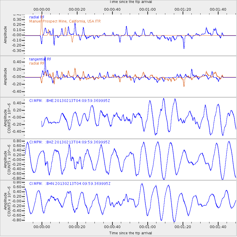
MPM Manuel Prospect Mine, California, USA - Earthquake Result Viewer
*The percent match for this event was below the threshold and hence no stack was calculated.
| Earthquake location: |
Kyushu, Japan |
| Earthquake latitude/longitude: |
30.3/131.4 |
| Earthquake time(UTC): |
2013/02/13 (044) 03:57:42 GMT |
| Earthquake Depth: |
10 km |
| Earthquake Magnitude: |
5.5 MB, 5.1 MS, 5.2 MW, 5.4 MW |
| Earthquake Catalog/Contributor: |
WHDF/NEIC |
|
| Network: |
CI Caltech Regional Seismic Network |
| Station: |
MPM Manuel Prospect Mine, California, USA |
| Lat/Lon: |
36.06 N/117.49 W |
| Elevation: |
185 m |
|
| Distance: |
87.6 deg |
| Az: |
49.167 deg |
| Baz: |
306.102 deg |
| Ray Param: |
$rayparam |
*The percent match for this event was below the threshold and hence was not used in the summary stack. |
|
| Radial Match: |
69.559715 % |
| Radial Bump: |
400 |
| Transverse Match: |
78.96955 % |
| Transverse Bump: |
400 |
| SOD ConfigId: |
494114 |
| Insert Time: |
2013-05-04 05:19:42.204 +0000 |
| GWidth: |
2.5 |
| Max Bumps: |
400 |
| Tol: |
0.001 |
|
Signal To Noise
| Channel | StoN | STA | LTA |
| CI:MPM: :BHZ:20130213T04:09:59.369995Z | 0.8176219 | 3.5786812E-7 | 4.3769387E-7 |
| CI:MPM: :BHN:20130213T04:09:59.369995Z | 0.6139925 | 2.6098982E-7 | 4.2507006E-7 |
| CI:MPM: :BHE:20130213T04:09:59.369995Z | 1.545843 | 1.9538747E-7 | 1.263954E-7 |
| Arrivals |
| Ps | |
| PpPs | |
| PsPs/PpSs | |


