You are here: Home > Network List > AV - Alaska Volcano Observatory Stations List
> Station MAPS Pakushin Southeast, Makushin Volcano, Alaska > Earthquake Result Viewer
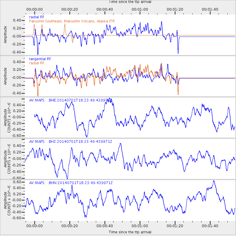
MAPS Pakushin Southeast, Makushin Volcano, Alaska - Earthquake Result Viewer
*The percent match for this event was below the threshold and hence no stack was calculated.
| Earthquake location: |
Kermadec Islands, New Zealand |
| Earthquake latitude/longitude: |
-30.3/-177.1 |
| Earthquake time(UTC): |
2014/07/01 (182) 18:11:51 GMT |
| Earthquake Depth: |
24 km |
| Earthquake Magnitude: |
5.2 MW |
| Earthquake Catalog/Contributor: |
ISC/ISC |
|
| Network: |
AV Alaska Volcano Observatory |
| Station: |
MAPS Pakushin Southeast, Makushin Volcano, Alaska |
| Lat/Lon: |
53.81 N/166.94 W |
| Elevation: |
333 m |
|
| Distance: |
84.2 deg |
| Az: |
6.02 deg |
| Baz: |
188.797 deg |
| Ray Param: |
$rayparam |
*The percent match for this event was below the threshold and hence was not used in the summary stack. |
|
| Radial Match: |
51.10687 % |
| Radial Bump: |
400 |
| Transverse Match: |
50.633533 % |
| Transverse Bump: |
400 |
| SOD ConfigId: |
3390531 |
| Insert Time: |
2019-04-12 15:35:13.393 +0000 |
| GWidth: |
2.5 |
| Max Bumps: |
400 |
| Tol: |
0.001 |
|
Signal To Noise
| Channel | StoN | STA | LTA |
| AV:MAPS: :BHZ:20140701T18:23:49.439971Z | 1.9389403 | 2.604006E-7 | 1.3430048E-7 |
| AV:MAPS: :BHN:20140701T18:23:49.439971Z | 2.272131 | 4.1297133E-7 | 1.8175507E-7 |
| AV:MAPS: :BHE:20140701T18:23:49.439971Z | 1.4690212 | 3.7110536E-7 | 2.5262085E-7 |
| Arrivals |
| Ps | |
| PpPs | |
| PsPs/PpSs | |


