You are here: Home > Network List > GT - Global Telemetered Seismograph Network (USAF/USGS) Stations List
> Station BOSA Boshof, South Africa > Earthquake Result Viewer
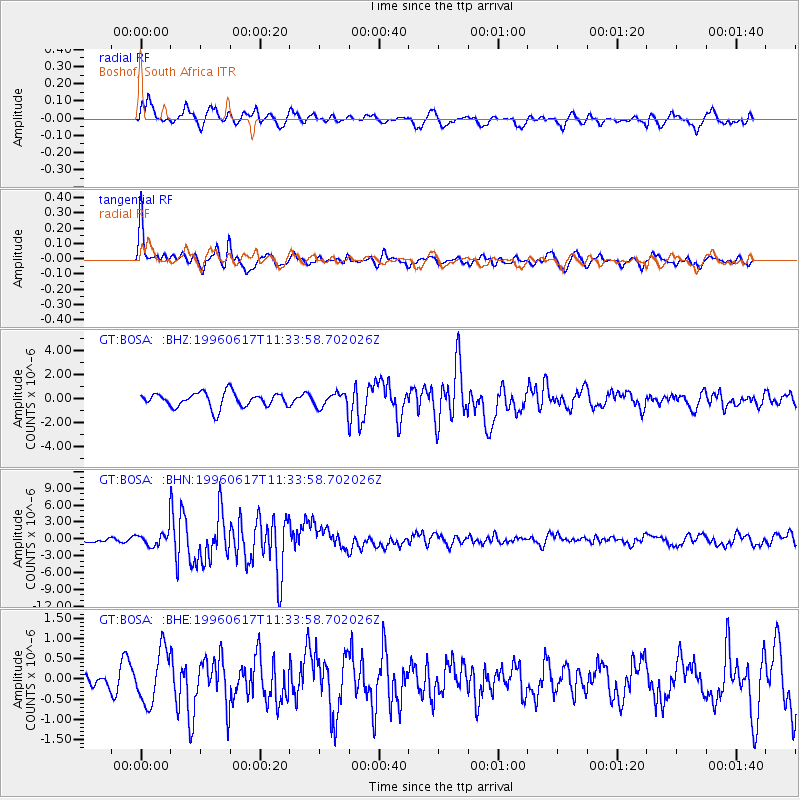
BOSA Boshof, South Africa - Earthquake Result Viewer
*The percent match for this event was below the threshold and hence no stack was calculated.
| Earthquake location: |
Flores Sea |
| Earthquake latitude/longitude: |
-7.1/122.6 |
| Earthquake time(UTC): |
1996/06/17 (169) 11:22:18 GMT |
| Earthquake Depth: |
587 km |
| Earthquake Magnitude: |
6.6 MB, 7.9 UNKNOWN, 7.8 MW |
| Earthquake Catalog/Contributor: |
WHDF/NEIC |
|
| Network: |
GT Global Telemetered Seismograph Network (USAF/USGS) |
| Station: |
BOSA Boshof, South Africa |
| Lat/Lon: |
28.61 S/25.26 E |
| Elevation: |
1280 m |
|
| Distance: |
93.0 deg |
| Az: |
240.836 deg |
| Baz: |
99.735 deg |
| Ray Param: |
$rayparam |
*The percent match for this event was below the threshold and hence was not used in the summary stack. |
|
| Radial Match: |
73.802475 % |
| Radial Bump: |
400 |
| Transverse Match: |
84.06106 % |
| Transverse Bump: |
351 |
| SOD ConfigId: |
4480 |
| Insert Time: |
2010-02-27 01:46:57.976 +0000 |
| GWidth: |
2.5 |
| Max Bumps: |
400 |
| Tol: |
0.001 |
|
Signal To Noise
| Channel | StoN | STA | LTA |
| GT:BOSA: :BHN:19960617T11:33:58.702026Z | 2.5402389 | 1.5851739E-6 | 6.240255E-7 |
| GT:BOSA: :BHE:19960617T11:33:58.702026Z | 2.2312198 | 6.5411956E-7 | 2.9316678E-7 |
| GT:BOSA: :BHZ:19960617T11:33:58.702026Z | 1.0139284 | 6.1430825E-7 | 6.0586945E-7 |
| Arrivals |
| Ps | |
| PpPs | |
| PsPs/PpSs | |


