You are here: Home > Network List > GT - Global Telemetered Seismograph Network (USAF/USGS) Stations List
> Station BOSA Boshof, South Africa > Earthquake Result Viewer
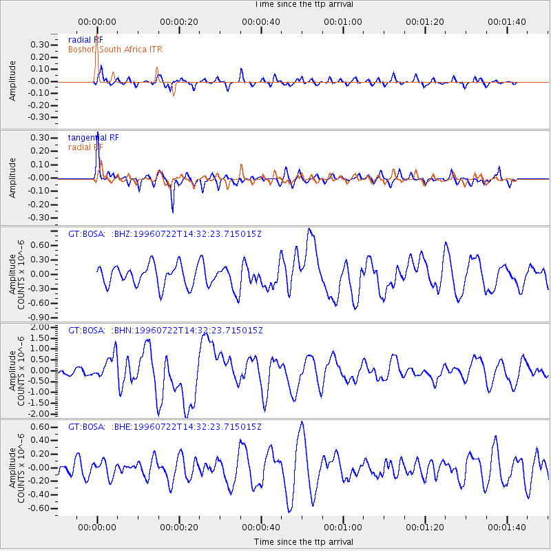
BOSA Boshof, South Africa - Earthquake Result Viewer
*The percent match for this event was below the threshold and hence no stack was calculated.
| Earthquake location: |
Minahassa Peninsula, Sulawesi |
| Earthquake latitude/longitude: |
1.0/120.4 |
| Earthquake time(UTC): |
1996/07/22 (204) 14:19:35 GMT |
| Earthquake Depth: |
33 km |
| Earthquake Magnitude: |
6.0 MB, 6.9 MS, 7.0 UNKNOWN, 6.9 MW |
| Earthquake Catalog/Contributor: |
WHDF/NEIC |
|
| Network: |
GT Global Telemetered Seismograph Network (USAF/USGS) |
| Station: |
BOSA Boshof, South Africa |
| Lat/Lon: |
28.61 S/25.26 E |
| Elevation: |
1280 m |
|
| Distance: |
95.0 deg |
| Az: |
241.522 deg |
| Baz: |
91.604 deg |
| Ray Param: |
$rayparam |
*The percent match for this event was below the threshold and hence was not used in the summary stack. |
|
| Radial Match: |
65.03772 % |
| Radial Bump: |
398 |
| Transverse Match: |
74.27386 % |
| Transverse Bump: |
312 |
| SOD ConfigId: |
4480 |
| Insert Time: |
2010-02-27 01:47:29.638 +0000 |
| GWidth: |
2.5 |
| Max Bumps: |
400 |
| Tol: |
0.001 |
|
Signal To Noise
| Channel | StoN | STA | LTA |
| GT:BOSA: :BHN:19960722T14:32:23.715015Z | 2.2126029 | 5.913969E-7 | 2.672856E-7 |
| GT:BOSA: :BHE:19960722T14:32:23.715015Z | 1.1118035 | 1.1684592E-7 | 1.0509583E-7 |
| GT:BOSA: :BHZ:19960722T14:32:23.715015Z | 1.2790747 | 2.7027806E-7 | 2.1130748E-7 |
| Arrivals |
| Ps | |
| PpPs | |
| PsPs/PpSs | |


