You are here: Home > Network List > GT - Global Telemetered Seismograph Network (USAF/USGS) Stations List
> Station BOSA Boshof, South Africa > Earthquake Result Viewer
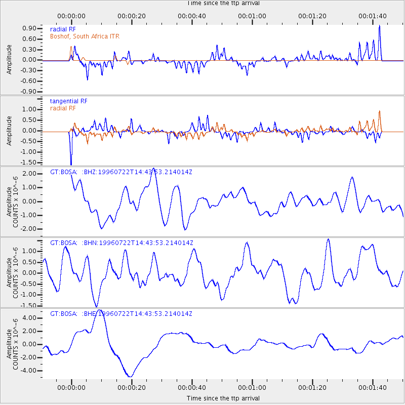
BOSA Boshof, South Africa - Earthquake Result Viewer
*The percent match for this event was below the threshold and hence no stack was calculated.
| Earthquake location: |
Minahassa Peninsula, Sulawesi |
| Earthquake latitude/longitude: |
1.0/120.5 |
| Earthquake time(UTC): |
1996/07/22 (204) 14:31:05 GMT |
| Earthquake Depth: |
33 km |
| Earthquake Magnitude: |
5.6 MB |
| Earthquake Catalog/Contributor: |
WHDF/NEIC |
|
| Network: |
GT Global Telemetered Seismograph Network (USAF/USGS) |
| Station: |
BOSA Boshof, South Africa |
| Lat/Lon: |
28.61 S/25.26 E |
| Elevation: |
1280 m |
|
| Distance: |
95.1 deg |
| Az: |
241.524 deg |
| Baz: |
91.577 deg |
| Ray Param: |
$rayparam |
*The percent match for this event was below the threshold and hence was not used in the summary stack. |
|
| Radial Match: |
42.40384 % |
| Radial Bump: |
221 |
| Transverse Match: |
60.00998 % |
| Transverse Bump: |
237 |
| SOD ConfigId: |
4480 |
| Insert Time: |
2010-02-27 01:47:32.929 +0000 |
| GWidth: |
2.5 |
| Max Bumps: |
400 |
| Tol: |
0.001 |
|
Signal To Noise
| Channel | StoN | STA | LTA |
| GT:BOSA: :BHN:19960722T14:43:53.214014Z | 0.89691377 | 4.3183906E-7 | 4.8147217E-7 |
| GT:BOSA: :BHE:19960722T14:43:53.214014Z | 3.085962 | 2.0089456E-6 | 6.5099493E-7 |
| GT:BOSA: :BHZ:19960722T14:43:53.214014Z | 1.0334013 | 1.0203717E-6 | 9.873916E-7 |
| Arrivals |
| Ps | |
| PpPs | |
| PsPs/PpSs | |


