You are here: Home > Network List > GT - Global Telemetered Seismograph Network (USAF/USGS) Stations List
> Station BOSA Boshof, South Africa > Earthquake Result Viewer
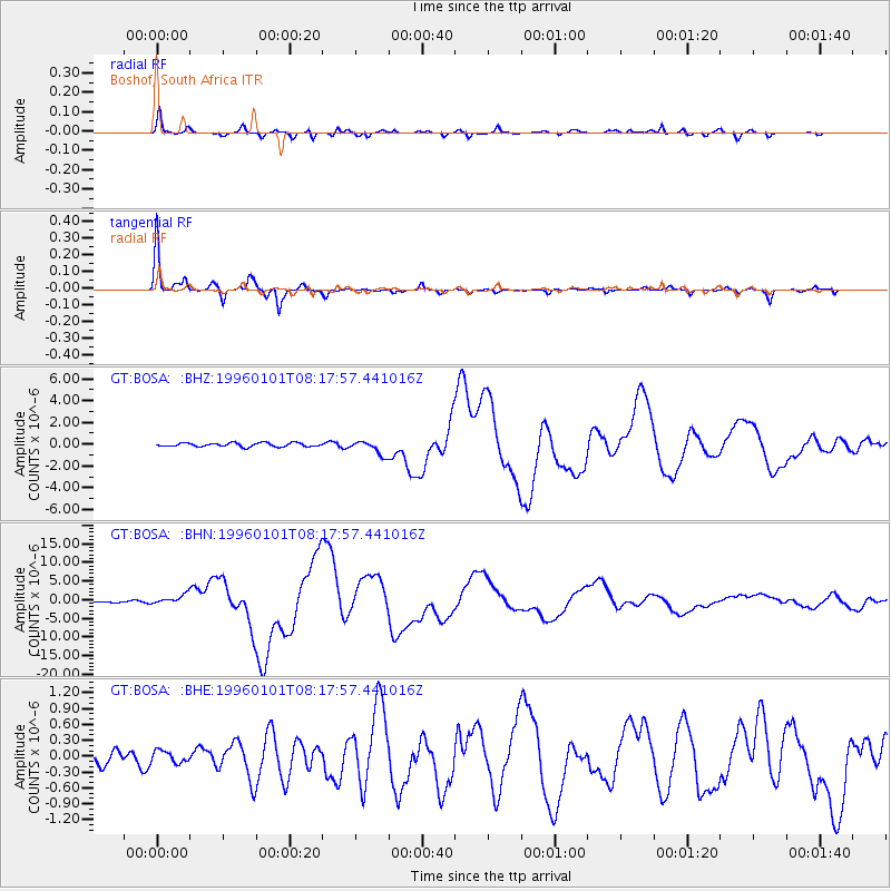
BOSA Boshof, South Africa - Earthquake Result Viewer
*The percent match for this event was below the threshold and hence no stack was calculated.
| Earthquake location: |
Minahassa Peninsula, Sulawesi |
| Earthquake latitude/longitude: |
0.7/120.0 |
| Earthquake time(UTC): |
1996/01/01 (001) 08:05:11 GMT |
| Earthquake Depth: |
33 km |
| Earthquake Magnitude: |
6.2 MB, 7.7 MS, 7.8 UNKNOWN, 7.8 MW |
| Earthquake Catalog/Contributor: |
WHDF/NEIC |
|
| Network: |
GT Global Telemetered Seismograph Network (USAF/USGS) |
| Station: |
BOSA Boshof, South Africa |
| Lat/Lon: |
28.61 S/25.26 E |
| Elevation: |
1280 m |
|
| Distance: |
94.5 deg |
| Az: |
241.513 deg |
| Baz: |
91.622 deg |
| Ray Param: |
$rayparam |
*The percent match for this event was below the threshold and hence was not used in the summary stack. |
|
| Radial Match: |
90.96252 % |
| Radial Bump: |
349 |
| Transverse Match: |
97.75266 % |
| Transverse Bump: |
203 |
| SOD ConfigId: |
4480 |
| Insert Time: |
2010-02-27 01:49:03.455 +0000 |
| GWidth: |
2.5 |
| Max Bumps: |
400 |
| Tol: |
0.001 |
|
Signal To Noise
| Channel | StoN | STA | LTA |
| GT:BOSA: :BHN:19960101T08:17:57.441016Z | 4.82469 | 1.2515684E-6 | 2.594091E-7 |
| GT:BOSA: :BHE:19960101T08:17:57.441016Z | 0.7865124 | 1.1246754E-7 | 1.4299525E-7 |
| GT:BOSA: :BHZ:19960101T08:17:57.441016Z | 3.6550107 | 6.3599816E-7 | 1.7400721E-7 |
| Arrivals |
| Ps | |
| PpPs | |
| PsPs/PpSs | |


