CPUP Villa Florida, Paraguay - Earthquake Result Viewer
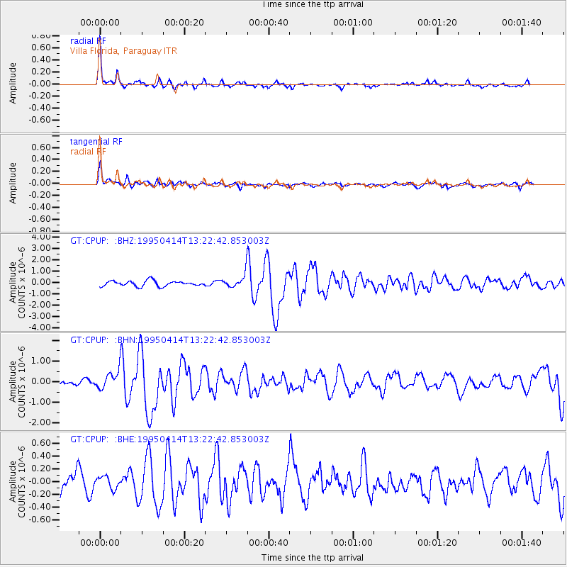
Earthquake location: Southwestern Atlantic Ocean
Earthquake latitude/longitude: -60.7/-20.0
Earthquake time(UTC): 1995/04/14 (104) 13:15:16 GMT
Earthquake Depth: 10 km
Earthquake Magnitude: 5.4 MB, 5.9 MS, 6.5 UNKNOWN, 6.3 MW
Earthquake Catalog/Contributor: WHDF/NEIC
Network: GT Global Telemetered Seismograph Network (USAF/USGS)
Station: CPUP Villa Florida, Paraguay
Lat/Lon: 26.33 S/57.33 W
Elevation: 105 m
Distance: 42.7 deg
Az: 306.516 deg
Baz: 153.83 deg
Ray Param: 0.07303287
Estimated Moho Depth: 37.0 km
Estimated Crust Vp/Vs: 1.65
Assumed Crust Vp: 6.498 km/s
Estimated Crust Vs: 3.932 km/s
Estimated Crust Poisson's Ratio: 0.21
Radial Match: 91.01952 %
Radial Bump: 270
Transverse Match: 84.654945 %
Transverse Bump: 389
SOD ConfigId: 6273
Insert Time: 2010-02-27 01:49:34.514 +0000
GWidth: 2.5
Max Bumps: 400
Tol: 0.001

Signal To Noise

ChannelStoNSTALTA
GT:CPUP: :BHN:19950414T13:22:42.853003Z3.45572454.7250296E-71.367305E-7
GT:CPUP: :BHE:19950414T13:22:42.853003Z0.6386539.78257E-81.5317505E-7
GT:CPUP: :BHZ:19950414T13:22:42.853003Z2.67081126.328781E-72.36961E-7
Arrivals
Ps4.0 SECOND
PpPs14 SECOND
PsPs/PpSs18 SECOND