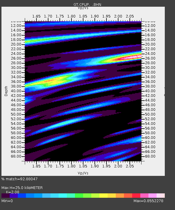
CPUP Villa Florida, Paraguay - Earthquake Result Viewer
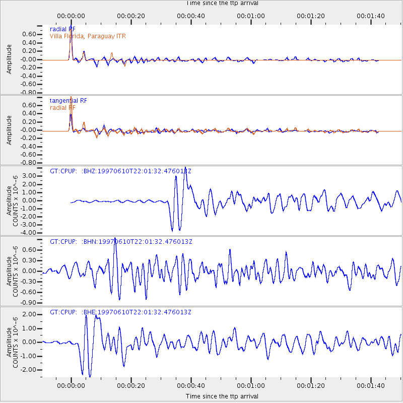
Earthquake location: Southern East Pacific Rise
Earthquake latitude/longitude: -35.8/-108.1
Earthquake time(UTC): 1997/06/10 (161) 21:53:55 GMT
Earthquake Depth: 10 km
Earthquake Magnitude: 5.8 MB, 6.1 MS, 6.5 UNKNOWN, 5.8 MS
Earthquake Catalog/Contributor: WHDF/NEIC
Network: GT Global Telemetered Seismograph Network (USAF/USGS)
Station: CPUP Villa Florida, Paraguay
Lat/Lon: 26.33 S/57.33 W
Elevation: 105 m
Distance: 44.1 deg
Az: 92.318 deg
Baz: 244.813 deg
Ray Param: 0.07211701
Estimated Moho Depth: 25.0 km
Estimated Crust Vp/Vs: 2.08
Assumed Crust Vp: 6.498 km/s
Estimated Crust Vs: 3.124 km/s
Estimated Crust Poisson's Ratio: 0.35
Radial Match: 92.88047 %
Radial Bump: 333
Transverse Match: 88.340355 %
Transverse Bump: 400
SOD ConfigId: 6273
Insert Time: 2010-02-27 01:49:40.662 +0000
GWidth: 2.5
Max Bumps: 400
Tol: 0.001

Signal To Noise

ChannelStoNSTALTA
GT:CPUP: :BHN:19970610T22:01:32.476013Z2.2262991.5475865E-76.951387E-8
GT:CPUP: :BHE:19970610T22:01:32.476013Z10.3236259.3634225E-79.069898E-8
GT:CPUP: :BHZ:19970610T22:01:32.476013Z16.7047181.4542845E-68.705831E-8
Arrivals
Ps4.4 SECOND
PpPs11 SECOND
PsPs/PpSs16 SECOND