You are here: Home > Network List > AZ - ANZA Regional Network Stations List
> Station LVA2 AZ.LVA2 > Earthquake Result Viewer
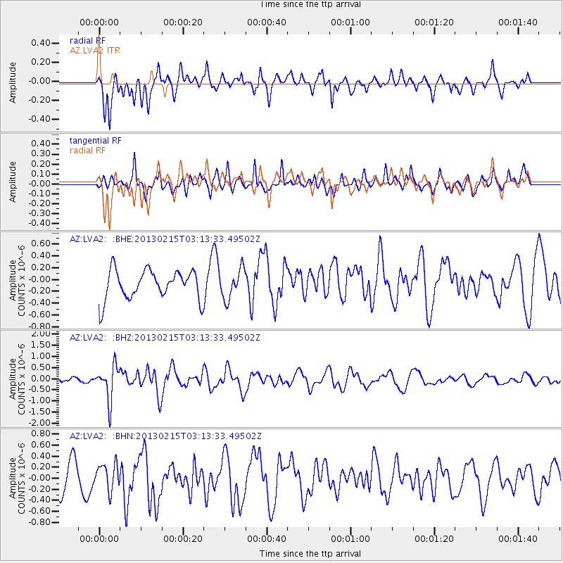
LVA2 AZ.LVA2 - Earthquake Result Viewer
*The percent match for this event was below the threshold and hence no stack was calculated.
| Earthquake location: |
Tonga Islands |
| Earthquake latitude/longitude: |
-19.7/-174.5 |
| Earthquake time(UTC): |
2013/02/15 (046) 03:02:23 GMT |
| Earthquake Depth: |
74 km |
| Earthquake Magnitude: |
5.8 MB, 5.7 MW, 5.8 MW |
| Earthquake Catalog/Contributor: |
WHDF/NEIC |
|
| Network: |
AZ ANZA Regional Network |
| Station: |
LVA2 AZ.LVA2 |
| Lat/Lon: |
33.35 N/116.56 W |
| Elevation: |
1435 m |
|
| Distance: |
76.4 deg |
| Az: |
46.849 deg |
| Baz: |
235.193 deg |
| Ray Param: |
$rayparam |
*The percent match for this event was below the threshold and hence was not used in the summary stack. |
|
| Radial Match: |
68.35125 % |
| Radial Bump: |
400 |
| Transverse Match: |
60.31518 % |
| Transverse Bump: |
400 |
| SOD ConfigId: |
494114 |
| Insert Time: |
2013-05-04 06:31:17.954 +0000 |
| GWidth: |
2.5 |
| Max Bumps: |
400 |
| Tol: |
0.001 |
|
Signal To Noise
| Channel | StoN | STA | LTA |
| AZ:LVA2: :BHZ:20130215T03:13:33.49502Z | 4.017251 | 7.9479537E-7 | 1.9784558E-7 |
| AZ:LVA2: :BHN:20130215T03:13:33.49502Z | 0.7965837 | 2.3218956E-7 | 2.9148168E-7 |
| AZ:LVA2: :BHE:20130215T03:13:33.49502Z | 1.0395025 | 2.556029E-7 | 2.4588968E-7 |
| Arrivals |
| Ps | |
| PpPs | |
| PsPs/PpSs | |


