You are here: Home > Network List > CI - Caltech Regional Seismic Network Stations List
> Station MUR Murrieta > Earthquake Result Viewer
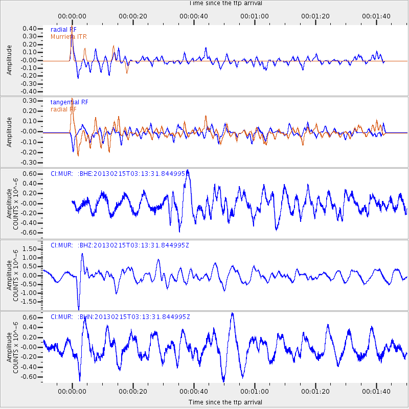
MUR Murrieta - Earthquake Result Viewer
*The percent match for this event was below the threshold and hence no stack was calculated.
| Earthquake location: |
Tonga Islands |
| Earthquake latitude/longitude: |
-19.7/-174.5 |
| Earthquake time(UTC): |
2013/02/15 (046) 03:02:23 GMT |
| Earthquake Depth: |
74 km |
| Earthquake Magnitude: |
5.8 MB, 5.7 MW, 5.8 MW |
| Earthquake Catalog/Contributor: |
WHDF/NEIC |
|
| Network: |
CI Caltech Regional Seismic Network |
| Station: |
MUR Murrieta |
| Lat/Lon: |
33.60 N/117.20 W |
| Elevation: |
562 m |
|
| Distance: |
76.1 deg |
| Az: |
46.327 deg |
| Baz: |
234.721 deg |
| Ray Param: |
$rayparam |
*The percent match for this event was below the threshold and hence was not used in the summary stack. |
|
| Radial Match: |
54.22816 % |
| Radial Bump: |
372 |
| Transverse Match: |
28.206697 % |
| Transverse Bump: |
285 |
| SOD ConfigId: |
494114 |
| Insert Time: |
2013-05-04 06:35:59.333 +0000 |
| GWidth: |
2.5 |
| Max Bumps: |
400 |
| Tol: |
0.001 |
|
Signal To Noise
| Channel | StoN | STA | LTA |
| CI:MUR: :BHZ:20130215T03:13:31.844995Z | 3.4194977 | 7.537067E-7 | 2.2041444E-7 |
| CI:MUR: :BHN:20130215T03:13:31.844995Z | 1.5887264 | 3.340787E-7 | 2.1028082E-7 |
| CI:MUR: :BHE:20130215T03:13:31.844995Z | 1.1524787 | 1.5772169E-7 | 1.3685431E-7 |
| Arrivals |
| Ps | |
| PpPs | |
| PsPs/PpSs | |


