You are here: Home > Network List > IW - Intermountain West Stations List
> Station MOOW Moose Ponds, Wyoming, USA > Earthquake Result Viewer
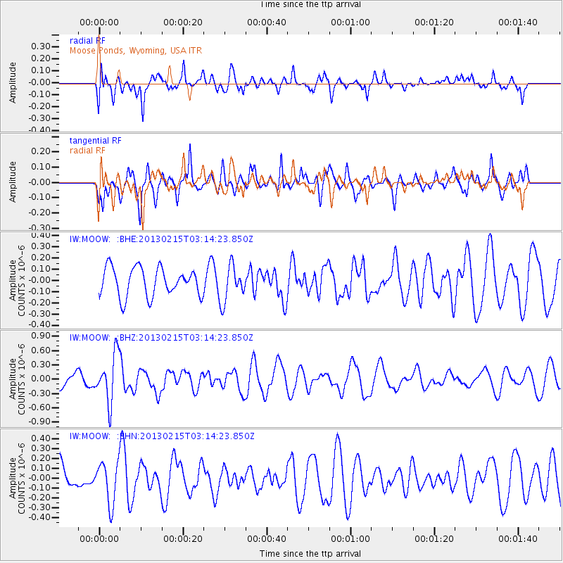
MOOW Moose Ponds, Wyoming, USA - Earthquake Result Viewer
*The percent match for this event was below the threshold and hence no stack was calculated.
| Earthquake location: |
Tonga Islands |
| Earthquake latitude/longitude: |
-19.7/-174.5 |
| Earthquake time(UTC): |
2013/02/15 (046) 03:02:23 GMT |
| Earthquake Depth: |
74 km |
| Earthquake Magnitude: |
5.8 MB, 5.7 MW, 5.8 MW |
| Earthquake Catalog/Contributor: |
WHDF/NEIC |
|
| Network: |
IW Intermountain West |
| Station: |
MOOW Moose Ponds, Wyoming, USA |
| Lat/Lon: |
43.75 N/110.74 W |
| Elevation: |
2128 m |
|
| Distance: |
85.9 deg |
| Az: |
40.65 deg |
| Baz: |
237.863 deg |
| Ray Param: |
$rayparam |
*The percent match for this event was below the threshold and hence was not used in the summary stack. |
|
| Radial Match: |
64.39425 % |
| Radial Bump: |
400 |
| Transverse Match: |
58.0503 % |
| Transverse Bump: |
400 |
| SOD ConfigId: |
494114 |
| Insert Time: |
2013-05-04 06:37:19.725 +0000 |
| GWidth: |
2.5 |
| Max Bumps: |
400 |
| Tol: |
0.001 |
|
Signal To Noise
| Channel | StoN | STA | LTA |
| IW:MOOW: :BHZ:20130215T03:14:23.850Z | 3.9262884 | 5.1000507E-7 | 1.2989496E-7 |
| IW:MOOW: :BHN:20130215T03:14:23.850Z | 1.6393946 | 2.1587154E-7 | 1.316776E-7 |
| IW:MOOW: :BHE:20130215T03:14:23.850Z | 1.2632216 | 1.5903333E-7 | 1.2589503E-7 |
| Arrivals |
| Ps | |
| PpPs | |
| PsPs/PpSs | |


