You are here: Home > Network List > TA - USArray Transportable Network (new EarthScope stations) Stations List
> Station WHTX Lake Whitney, Meridian, TX, USA > Earthquake Result Viewer
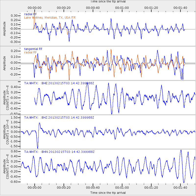
WHTX Lake Whitney, Meridian, TX, USA - Earthquake Result Viewer
*The percent match for this event was below the threshold and hence no stack was calculated.
| Earthquake location: |
Tonga Islands |
| Earthquake latitude/longitude: |
-19.7/-174.5 |
| Earthquake time(UTC): |
2013/02/15 (046) 03:02:23 GMT |
| Earthquake Depth: |
74 km |
| Earthquake Magnitude: |
5.8 MB, 5.7 MW, 5.8 MW |
| Earthquake Catalog/Contributor: |
WHDF/NEIC |
|
| Network: |
TA USArray Transportable Network (new EarthScope stations) |
| Station: |
WHTX Lake Whitney, Meridian, TX, USA |
| Lat/Lon: |
31.99 N/97.46 W |
| Elevation: |
190 m |
|
| Distance: |
89.8 deg |
| Az: |
55.891 deg |
| Baz: |
246.621 deg |
| Ray Param: |
$rayparam |
*The percent match for this event was below the threshold and hence was not used in the summary stack. |
|
| Radial Match: |
62.630417 % |
| Radial Bump: |
325 |
| Transverse Match: |
47.94892 % |
| Transverse Bump: |
341 |
| SOD ConfigId: |
494114 |
| Insert Time: |
2013-05-04 06:40:44.245 +0000 |
| GWidth: |
2.5 |
| Max Bumps: |
400 |
| Tol: |
0.001 |
|
Signal To Noise
| Channel | StoN | STA | LTA |
| TA:WHTX: :BHZ:20130215T03:14:42.399988Z | 8.911983 | 7.2216864E-7 | 8.103344E-8 |
| TA:WHTX: :BHN:20130215T03:14:42.399988Z | 2.2157419 | 3.0663907E-7 | 1.3839114E-7 |
| TA:WHTX: :BHE:20130215T03:14:42.399988Z | 1.6532863 | 2.4417147E-7 | 1.4768855E-7 |
| Arrivals |
| Ps | |
| PpPs | |
| PsPs/PpSs | |


