You are here: Home > Network List > TA - USArray Transportable Network (new EarthScope stations) Stations List
> Station G03D McMinnville, OR, USA > Earthquake Result Viewer
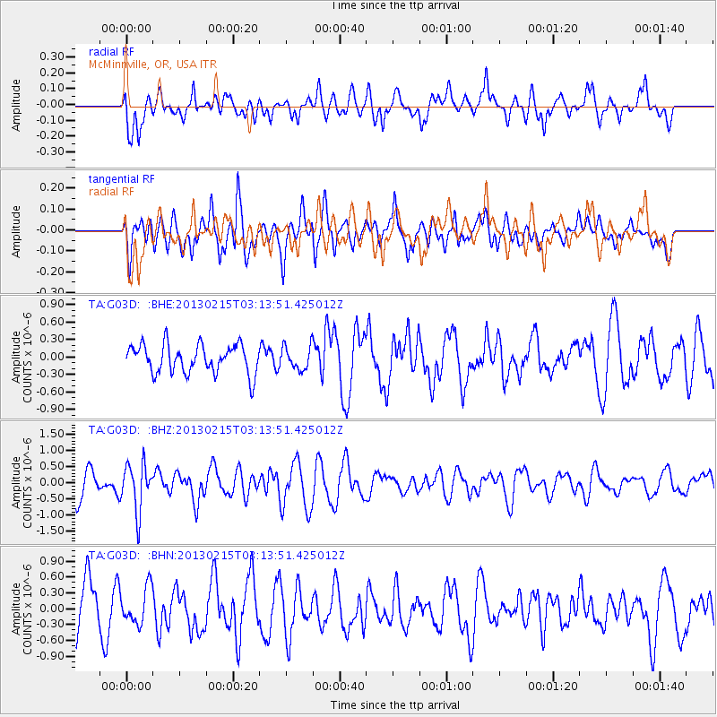
G03D McMinnville, OR, USA - Earthquake Result Viewer
*The percent match for this event was below the threshold and hence no stack was calculated.
| Earthquake location: |
Tonga Islands |
| Earthquake latitude/longitude: |
-19.7/-174.5 |
| Earthquake time(UTC): |
2013/02/15 (046) 03:02:23 GMT |
| Earthquake Depth: |
74 km |
| Earthquake Magnitude: |
5.8 MB, 5.7 MW, 5.8 MW |
| Earthquake Catalog/Contributor: |
WHDF/NEIC |
|
| Network: |
TA USArray Transportable Network (new EarthScope stations) |
| Station: |
G03D McMinnville, OR, USA |
| Lat/Lon: |
45.21 N/123.26 W |
| Elevation: |
222 m |
|
| Distance: |
79.6 deg |
| Az: |
34.058 deg |
| Baz: |
228.272 deg |
| Ray Param: |
$rayparam |
*The percent match for this event was below the threshold and hence was not used in the summary stack. |
|
| Radial Match: |
59.570953 % |
| Radial Bump: |
400 |
| Transverse Match: |
58.925545 % |
| Transverse Bump: |
400 |
| SOD ConfigId: |
494114 |
| Insert Time: |
2013-05-04 06:41:16.475 +0000 |
| GWidth: |
2.5 |
| Max Bumps: |
400 |
| Tol: |
0.001 |
|
Signal To Noise
| Channel | StoN | STA | LTA |
| TA:G03D: :BHZ:20130215T03:13:51.425012Z | 1.8805256 | 7.292109E-7 | 3.8776975E-7 |
| TA:G03D: :BHN:20130215T03:13:51.425012Z | 0.822603 | 3.4026561E-7 | 4.1364504E-7 |
| TA:G03D: :BHE:20130215T03:13:51.425012Z | 0.81582963 | 1.9932605E-7 | 2.4432313E-7 |
| Arrivals |
| Ps | |
| PpPs | |
| PsPs/PpSs | |


