You are here: Home > Network List > TA - USArray Transportable Network (new EarthScope stations) Stations List
> Station K39A Oelwein, IA, USA > Earthquake Result Viewer
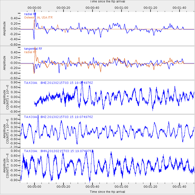
K39A Oelwein, IA, USA - Earthquake Result Viewer
*The percent match for this event was below the threshold and hence no stack was calculated.
| Earthquake location: |
Tonga Islands |
| Earthquake latitude/longitude: |
-19.7/-174.5 |
| Earthquake time(UTC): |
2013/02/15 (046) 03:02:23 GMT |
| Earthquake Depth: |
74 km |
| Earthquake Magnitude: |
5.8 MB, 5.7 MW, 5.8 MW |
| Earthquake Catalog/Contributor: |
WHDF/NEIC |
|
| Network: |
TA USArray Transportable Network (new EarthScope stations) |
| Station: |
K39A Oelwein, IA, USA |
| Lat/Lon: |
42.71 N/91.89 W |
| Elevation: |
332 m |
|
| Distance: |
97.9 deg |
| Az: |
47.554 deg |
| Baz: |
250.564 deg |
| Ray Param: |
$rayparam |
*The percent match for this event was below the threshold and hence was not used in the summary stack. |
|
| Radial Match: |
69.408134 % |
| Radial Bump: |
400 |
| Transverse Match: |
37.078484 % |
| Transverse Bump: |
400 |
| SOD ConfigId: |
494114 |
| Insert Time: |
2013-05-04 06:42:45.040 +0000 |
| GWidth: |
2.5 |
| Max Bumps: |
400 |
| Tol: |
0.001 |
|
Signal To Noise
| Channel | StoN | STA | LTA |
| TA:K39A: :BHZ:20130215T03:15:19.074976Z | 1.7314489 | 5.24668E-7 | 3.0302252E-7 |
| TA:K39A: :BHN:20130215T03:15:19.074976Z | 0.9680421 | 3.5796864E-7 | 3.6978625E-7 |
| TA:K39A: :BHE:20130215T03:15:19.074976Z | 2.4924614 | 4.879512E-7 | 1.957708E-7 |
| Arrivals |
| Ps | |
| PpPs | |
| PsPs/PpSs | |


