You are here: Home > Network List > UW - Pacific Northwest Regional Seismic Network Stations List
> Station MRBL Marblemount, WA, USA > Earthquake Result Viewer
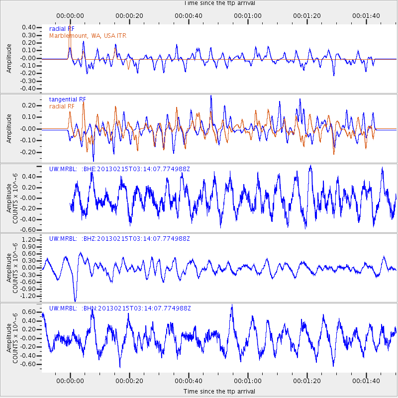
MRBL Marblemount, WA, USA - Earthquake Result Viewer
*The percent match for this event was below the threshold and hence no stack was calculated.
| Earthquake location: |
Tonga Islands |
| Earthquake latitude/longitude: |
-19.7/-174.5 |
| Earthquake time(UTC): |
2013/02/15 (046) 03:02:23 GMT |
| Earthquake Depth: |
74 km |
| Earthquake Magnitude: |
5.8 MB, 5.7 MW, 5.8 MW |
| Earthquake Catalog/Contributor: |
WHDF/NEIC |
|
| Network: |
UW Pacific Northwest Regional Seismic Network |
| Station: |
MRBL Marblemount, WA, USA |
| Lat/Lon: |
48.52 N/121.48 W |
| Elevation: |
75 m |
|
| Distance: |
82.7 deg |
| Az: |
32.354 deg |
| Baz: |
229.307 deg |
| Ray Param: |
$rayparam |
*The percent match for this event was below the threshold and hence was not used in the summary stack. |
|
| Radial Match: |
65.84892 % |
| Radial Bump: |
400 |
| Transverse Match: |
59.691196 % |
| Transverse Bump: |
373 |
| SOD ConfigId: |
494114 |
| Insert Time: |
2013-05-04 06:44:11.182 +0000 |
| GWidth: |
2.5 |
| Max Bumps: |
400 |
| Tol: |
0.001 |
|
Signal To Noise
| Channel | StoN | STA | LTA |
| UW:MRBL: :BHZ:20130215T03:14:07.774988Z | 4.1223383 | 6.41595E-7 | 1.556386E-7 |
| UW:MRBL: :BHN:20130215T03:14:07.774988Z | 0.66325617 | 1.4458706E-7 | 2.1799579E-7 |
| UW:MRBL: :BHE:20130215T03:14:07.774988Z | 0.9630479 | 1.9241114E-7 | 1.9979394E-7 |
| Arrivals |
| Ps | |
| PpPs | |
| PsPs/PpSs | |


