You are here: Home > Network List > GT - Global Telemetered Seismograph Network (USAF/USGS) Stations List
> Station CPUP Villa Florida, Paraguay > Earthquake Result Viewer
CPUP Villa Florida, Paraguay - Earthquake Result Viewer

| Earthquake location: |
South Of Panama |
| Earthquake latitude/longitude: |
6.6/-82.3 |
| Earthquake time(UTC): |
2006/01/06 (006) 03:39:58 GMT |
| Earthquake Depth: |
7.4 km |
| Earthquake Magnitude: |
5.9 MB, 5.5 MS, 6.1 MW, 6.0 MW |
| Earthquake Catalog/Contributor: |
WHDF/NEIC |
|
| Network: |
GT Global Telemetered Seismograph Network (USAF/USGS) |
| Station: |
CPUP Villa Florida, Paraguay |
| Lat/Lon: |
26.33 S/57.33 W |
| Elevation: |
105 m |
|
| Distance: |
40.8 deg |
| Az: |
144.488 deg |
| Baz: |
319.985 deg |
| Ray Param: |
0.074209675 |
| Estimated Moho Depth: |
30.0 km |
| Estimated Crust Vp/Vs: |
1.91 |
| Assumed Crust Vp: |
6.498 km/s |
| Estimated Crust Vs: |
3.397 km/s |
| Estimated Crust Poisson's Ratio: |
0.31 |
|
| Radial Match: |
87.29879 % |
| Radial Bump: |
338 |
| Transverse Match: |
61.871685 % |
| Transverse Bump: |
400 |
| SOD ConfigId: |
2422 |
| Insert Time: |
2010-02-27 01:50:32.921 +0000 |
| GWidth: |
2.5 |
| Max Bumps: |
400 |
| Tol: |
0.001 |
|
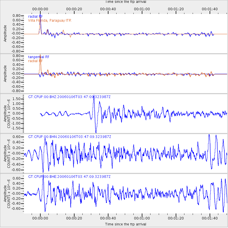
Signal To Noise
| Channel | StoN | STA | LTA |
| GT:CPUP:00:BHN:20060106T03:47:09.323987Z | 4.7785234 | 3.4019592E-7 | 7.119269E-8 |
| GT:CPUP:00:BHE:20060106T03:47:09.323987Z | 8.081769 | 3.6804693E-7 | 4.5540393E-8 |
| GT:CPUP:00:BHZ:20060106T03:47:09.323987Z | 8.56781 | 9.817915E-7 | 1.1459071E-7 |
| Arrivals |
| Ps | 4.5 SECOND |
| PpPs | 13 SECOND |
| PsPs/PpSs | 17 SECOND |


