You are here: Home > Network List > TA - USArray Transportable Network (new EarthScope stations) Stations List
> Station Y12C Blythe, CA, USA > Earthquake Result Viewer
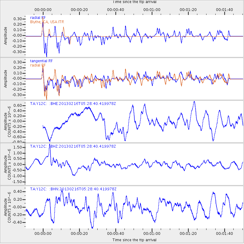
Y12C Blythe, CA, USA - Earthquake Result Viewer
*The percent match for this event was below the threshold and hence no stack was calculated.
| Earthquake location: |
Off E. Coast Of N. Island, N.Z. |
| Earthquake latitude/longitude: |
-36.5/177.9 |
| Earthquake time(UTC): |
2013/02/16 (047) 05:16:17 GMT |
| Earthquake Depth: |
207 km |
| Earthquake Magnitude: |
5.7 MB, 5.8 MW, 5.8 MW |
| Earthquake Catalog/Contributor: |
WHDF/NEIC |
|
| Network: |
TA USArray Transportable Network (new EarthScope stations) |
| Station: |
Y12C Blythe, CA, USA |
| Lat/Lon: |
33.75 N/114.52 W |
| Elevation: |
196 m |
|
| Distance: |
94.1 deg |
| Az: |
50.53 deg |
| Baz: |
228.281 deg |
| Ray Param: |
$rayparam |
*The percent match for this event was below the threshold and hence was not used in the summary stack. |
|
| Radial Match: |
62.101555 % |
| Radial Bump: |
400 |
| Transverse Match: |
70.91581 % |
| Transverse Bump: |
400 |
| SOD ConfigId: |
494114 |
| Insert Time: |
2013-05-04 06:56:18.431 +0000 |
| GWidth: |
2.5 |
| Max Bumps: |
400 |
| Tol: |
0.001 |
|
Signal To Noise
| Channel | StoN | STA | LTA |
| TA:Y12C: :BHZ:20130216T05:28:40.419978Z | 4.090064 | 9.3511534E-7 | 2.2863097E-7 |
| TA:Y12C: :BHN:20130216T05:28:40.419978Z | 1.1047952 | 1.8121695E-7 | 1.6402763E-7 |
| TA:Y12C: :BHE:20130216T05:28:40.419978Z | 0.722197 | 2.501494E-7 | 3.4637284E-7 |
| Arrivals |
| Ps | |
| PpPs | |
| PsPs/PpSs | |


