You are here: Home > Network List > CI - Caltech Regional Seismic Network Stations List
> Station BEL Belle Mtn, Joshua Tree National Park, CA, USA > Earthquake Result Viewer
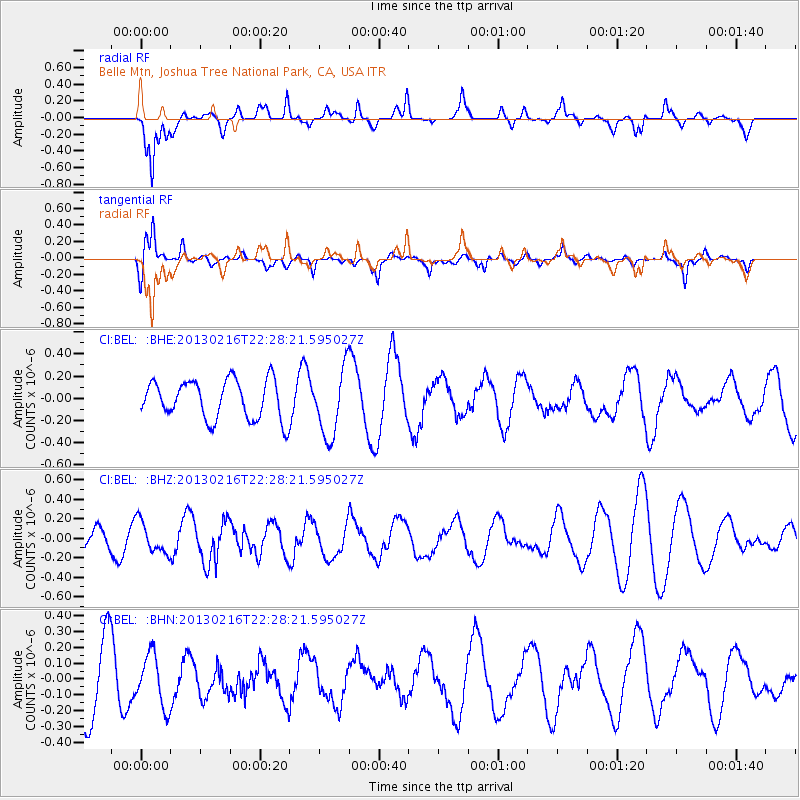
BEL Belle Mtn, Joshua Tree National Park, CA, USA - Earthquake Result Viewer
*The percent match for this event was below the threshold and hence no stack was calculated.
| Earthquake location: |
Kuril Islands |
| Earthquake latitude/longitude: |
43.5/146.7 |
| Earthquake time(UTC): |
2013/02/16 (047) 22:17:32 GMT |
| Earthquake Depth: |
46 km |
| Earthquake Magnitude: |
5.6 MB, 5.1 MS, 5.3 MW, 5.4 MW |
| Earthquake Catalog/Contributor: |
WHDF/NEIC |
|
| Network: |
CI Caltech Regional Seismic Network |
| Station: |
BEL Belle Mtn, Joshua Tree National Park, CA, USA |
| Lat/Lon: |
34.00 N/116.00 W |
| Elevation: |
1388 m |
|
| Distance: |
72.2 deg |
| Az: |
59.907 deg |
| Baz: |
310.767 deg |
| Ray Param: |
$rayparam |
*The percent match for this event was below the threshold and hence was not used in the summary stack. |
|
| Radial Match: |
68.98243 % |
| Radial Bump: |
400 |
| Transverse Match: |
74.82539 % |
| Transverse Bump: |
400 |
| SOD ConfigId: |
494114 |
| Insert Time: |
2013-05-04 07:00:18.437 +0000 |
| GWidth: |
2.5 |
| Max Bumps: |
400 |
| Tol: |
0.001 |
|
Signal To Noise
| Channel | StoN | STA | LTA |
| CI:BEL: :BHZ:20130216T22:28:21.595027Z | 1.5618767 | 1.6371573E-7 | 1.0481988E-7 |
| CI:BEL: :BHN:20130216T22:28:21.595027Z | 0.61140376 | 1.6489632E-7 | 2.697012E-7 |
| CI:BEL: :BHE:20130216T22:28:21.595027Z | 1.7475867 | 3.0533465E-7 | 1.7471788E-7 |
| Arrivals |
| Ps | |
| PpPs | |
| PsPs/PpSs | |


