You are here: Home > Network List > TA - USArray Transportable Network (new EarthScope stations) Stations List
> Station O41A Passley's Farm, La Prairie, IL, USA > Earthquake Result Viewer
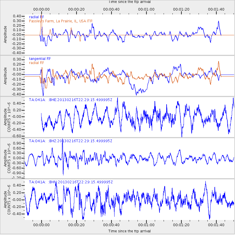
O41A Passley's Farm, La Prairie, IL, USA - Earthquake Result Viewer
*The percent match for this event was below the threshold and hence no stack was calculated.
| Earthquake location: |
Kuril Islands |
| Earthquake latitude/longitude: |
43.5/146.7 |
| Earthquake time(UTC): |
2013/02/16 (047) 22:17:32 GMT |
| Earthquake Depth: |
46 km |
| Earthquake Magnitude: |
5.6 MB, 5.1 MS, 5.3 MW, 5.4 MW |
| Earthquake Catalog/Contributor: |
WHDF/NEIC |
|
| Network: |
TA USArray Transportable Network (new EarthScope stations) |
| Station: |
O41A Passley's Farm, La Prairie, IL, USA |
| Lat/Lon: |
40.12 N/90.88 W |
| Elevation: |
203 m |
|
| Distance: |
81.9 deg |
| Az: |
40.825 deg |
| Baz: |
321.688 deg |
| Ray Param: |
$rayparam |
*The percent match for this event was below the threshold and hence was not used in the summary stack. |
|
| Radial Match: |
49.427338 % |
| Radial Bump: |
400 |
| Transverse Match: |
48.408115 % |
| Transverse Bump: |
400 |
| SOD ConfigId: |
494114 |
| Insert Time: |
2013-05-04 07:06:01.295 +0000 |
| GWidth: |
2.5 |
| Max Bumps: |
400 |
| Tol: |
0.001 |
|
Signal To Noise
| Channel | StoN | STA | LTA |
| TA:O41A: :BHZ:20130216T22:29:15.499995Z | 0.9940482 | 2.3700248E-7 | 2.3842153E-7 |
| TA:O41A: :BHN:20130216T22:29:15.499995Z | 0.67736536 | 1.7640737E-7 | 2.6043165E-7 |
| TA:O41A: :BHE:20130216T22:29:15.499995Z | 1.1794144 | 2.3356976E-7 | 1.9803876E-7 |
| Arrivals |
| Ps | |
| PpPs | |
| PsPs/PpSs | |


