You are here: Home > Network List > TA - USArray Transportable Network (new EarthScope stations) Stations List
> Station Y48A Jasper, AL, USA > Earthquake Result Viewer
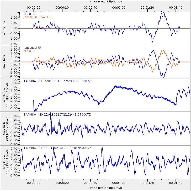
Y48A Jasper, AL, USA - Earthquake Result Viewer
*The percent match for this event was below the threshold and hence no stack was calculated.
| Earthquake location: |
Kuril Islands |
| Earthquake latitude/longitude: |
43.5/146.7 |
| Earthquake time(UTC): |
2013/02/16 (047) 22:17:32 GMT |
| Earthquake Depth: |
46 km |
| Earthquake Magnitude: |
5.6 MB, 5.1 MS, 5.3 MW, 5.4 MW |
| Earthquake Catalog/Contributor: |
WHDF/NEIC |
|
| Network: |
TA USArray Transportable Network (new EarthScope stations) |
| Station: |
Y48A Jasper, AL, USA |
| Lat/Lon: |
33.91 N/87.17 W |
| Elevation: |
170 m |
|
| Distance: |
88.6 deg |
| Az: |
42.195 deg |
| Baz: |
324.032 deg |
| Ray Param: |
$rayparam |
*The percent match for this event was below the threshold and hence was not used in the summary stack. |
|
| Radial Match: |
10.860872 % |
| Radial Bump: |
400 |
| Transverse Match: |
11.643409 % |
| Transverse Bump: |
400 |
| SOD ConfigId: |
494114 |
| Insert Time: |
2013-05-04 07:08:29.607 +0000 |
| GWidth: |
2.5 |
| Max Bumps: |
400 |
| Tol: |
0.001 |
|
Signal To Noise
| Channel | StoN | STA | LTA |
| TA:Y48A: :BHZ:20130216T22:29:48.950007Z | 0.63538235 | 1.2341343E-7 | 1.9423491E-7 |
| TA:Y48A: :BHN:20130216T22:29:48.950007Z | 0.9527966 | 1.558525E-7 | 1.6357374E-7 |
| TA:Y48A: :BHE:20130216T22:29:48.950007Z | 0.98194814 | 1.5494869E-6 | 1.5779723E-6 |
| Arrivals |
| Ps | |
| PpPs | |
| PsPs/PpSs | |


