You are here: Home > Network List > TA - USArray Transportable Network (new EarthScope stations) Stations List
> Station Q50A Georgetown, OH, USA > Earthquake Result Viewer
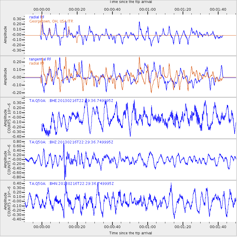
Q50A Georgetown, OH, USA - Earthquake Result Viewer
*The percent match for this event was below the threshold and hence no stack was calculated.
| Earthquake location: |
Kuril Islands |
| Earthquake latitude/longitude: |
43.5/146.7 |
| Earthquake time(UTC): |
2013/02/16 (047) 22:17:32 GMT |
| Earthquake Depth: |
46 km |
| Earthquake Magnitude: |
5.6 MB, 5.1 MS, 5.3 MW, 5.4 MW |
| Earthquake Catalog/Contributor: |
WHDF/NEIC |
|
| Network: |
TA USArray Transportable Network (new EarthScope stations) |
| Station: |
Q50A Georgetown, OH, USA |
| Lat/Lon: |
38.84 N/83.98 W |
| Elevation: |
262 m |
|
| Distance: |
86.1 deg |
| Az: |
37.253 deg |
| Baz: |
325.687 deg |
| Ray Param: |
$rayparam |
*The percent match for this event was below the threshold and hence was not used in the summary stack. |
|
| Radial Match: |
47.901924 % |
| Radial Bump: |
400 |
| Transverse Match: |
55.00454 % |
| Transverse Bump: |
400 |
| SOD ConfigId: |
494114 |
| Insert Time: |
2013-05-04 07:09:43.298 +0000 |
| GWidth: |
2.5 |
| Max Bumps: |
400 |
| Tol: |
0.001 |
|
Signal To Noise
| Channel | StoN | STA | LTA |
| TA:Q50A: :BHZ:20130216T22:29:36.749995Z | 1.9006882 | 2.4044581E-7 | 1.265046E-7 |
| TA:Q50A: :BHN:20130216T22:29:36.749995Z | 1.0255666 | 1.2227198E-7 | 1.1922384E-7 |
| TA:Q50A: :BHE:20130216T22:29:36.749995Z | 1.2594814 | 1.9162755E-7 | 1.5214799E-7 |
| Arrivals |
| Ps | |
| PpPs | |
| PsPs/PpSs | |


