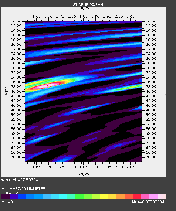
CPUP Villa Florida, Paraguay - Earthquake Result Viewer
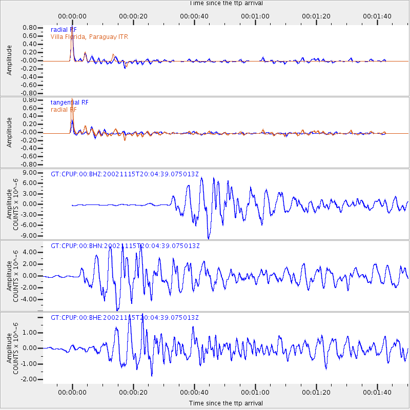
Earthquake location: South Georgia Island Region
Earthquake latitude/longitude: -56.1/-36.4
Earthquake time(UTC): 2002/11/15 (319) 19:58:31 GMT
Earthquake Depth: 10 km
Earthquake Magnitude: 6.1 MB, 6.6 MS, 6.7 MW, 6.4 MW
Earthquake Catalog/Contributor: WHDF/NEIC
Network: GT Global Telemetered Seismograph Network (USAF/USGS)
Station: CPUP Villa Florida, Paraguay
Lat/Lon: 26.33 S/57.33 W
Elevation: 105 m
Distance: 33.3 deg
Az: 324.318 deg
Baz: 158.614 deg
Ray Param: 0.07825475
Estimated Moho Depth: 37.25 km
Estimated Crust Vp/Vs: 1.70
Assumed Crust Vp: 6.498 km/s
Estimated Crust Vs: 3.833 km/s
Estimated Crust Poisson's Ratio: 0.23
Radial Match: 97.50724 %
Radial Bump: 299
Transverse Match: 91.53941 %
Transverse Bump: 400
SOD ConfigId: 4714
Insert Time: 2010-02-27 01:50:45.297 +0000
GWidth: 2.5
Max Bumps: 400
Tol: 0.001

Signal To Noise

ChannelStoNSTALTA
GT:CPUP:00:BHN:20021115T20:04:39.075013Z5.461315.833343E-71.0681216E-7
GT:CPUP:00:BHE:20021115T20:04:39.075013Z1.01898651.1372391E-71.11604926E-7
GT:CPUP:00:BHZ:20021115T20:04:39.075013Z8.8035429.822982E-71.1157988E-7
Arrivals
Ps4.3 SECOND
PpPs14 SECOND
PsPs/PpSs19 SECOND