You are here: Home > Network List > CI - Caltech Regional Seismic Network Stations List
> Station MPM Manuel Prospect Mine, California, USA > Earthquake Result Viewer
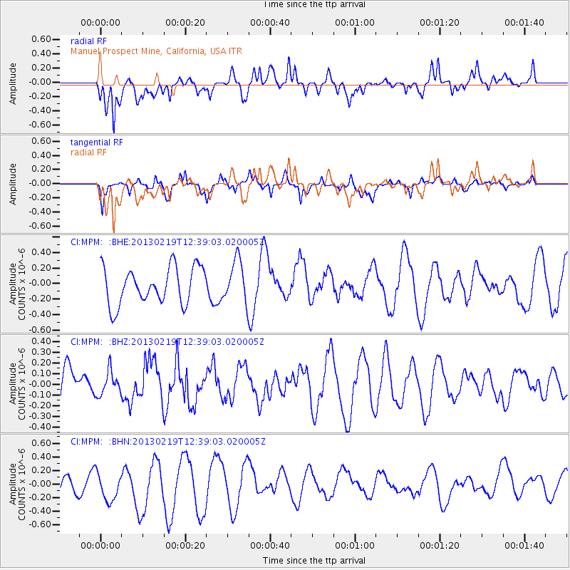
MPM Manuel Prospect Mine, California, USA - Earthquake Result Viewer
*The percent match for this event was below the threshold and hence no stack was calculated.
| Earthquake location: |
Near East Coast Of Honshu, Japan |
| Earthquake latitude/longitude: |
35.3/141.0 |
| Earthquake time(UTC): |
2013/02/19 (050) 12:27:36 GMT |
| Earthquake Depth: |
20 km |
| Earthquake Magnitude: |
5.5 MB, 5.2 MS, 5.4 MW, 5.3 MW |
| Earthquake Catalog/Contributor: |
WHDF/NEIC |
|
| Network: |
CI Caltech Regional Seismic Network |
| Station: |
MPM Manuel Prospect Mine, California, USA |
| Lat/Lon: |
36.06 N/117.49 W |
| Elevation: |
185 m |
|
| Distance: |
78.2 deg |
| Az: |
54.184 deg |
| Baz: |
305.009 deg |
| Ray Param: |
$rayparam |
*The percent match for this event was below the threshold and hence was not used in the summary stack. |
|
| Radial Match: |
54.49197 % |
| Radial Bump: |
400 |
| Transverse Match: |
60.957638 % |
| Transverse Bump: |
387 |
| SOD ConfigId: |
494114 |
| Insert Time: |
2013-05-09 04:07:22.678 +0000 |
| GWidth: |
2.5 |
| Max Bumps: |
400 |
| Tol: |
0.001 |
|
Signal To Noise
| Channel | StoN | STA | LTA |
| CI:MPM: :BHZ:20130219T12:39:03.020005Z | 0.71605676 | 1.1219756E-7 | 1.5668809E-7 |
| CI:MPM: :BHN:20130219T12:39:03.020005Z | 2.0025716 | 2.3976605E-7 | 1.197291E-7 |
| CI:MPM: :BHE:20130219T12:39:03.020005Z | 1.1883041 | 2.79869E-7 | 2.3551968E-7 |
| Arrivals |
| Ps | |
| PpPs | |
| PsPs/PpSs | |


