CPUP Villa Florida, Paraguay - Earthquake Result Viewer
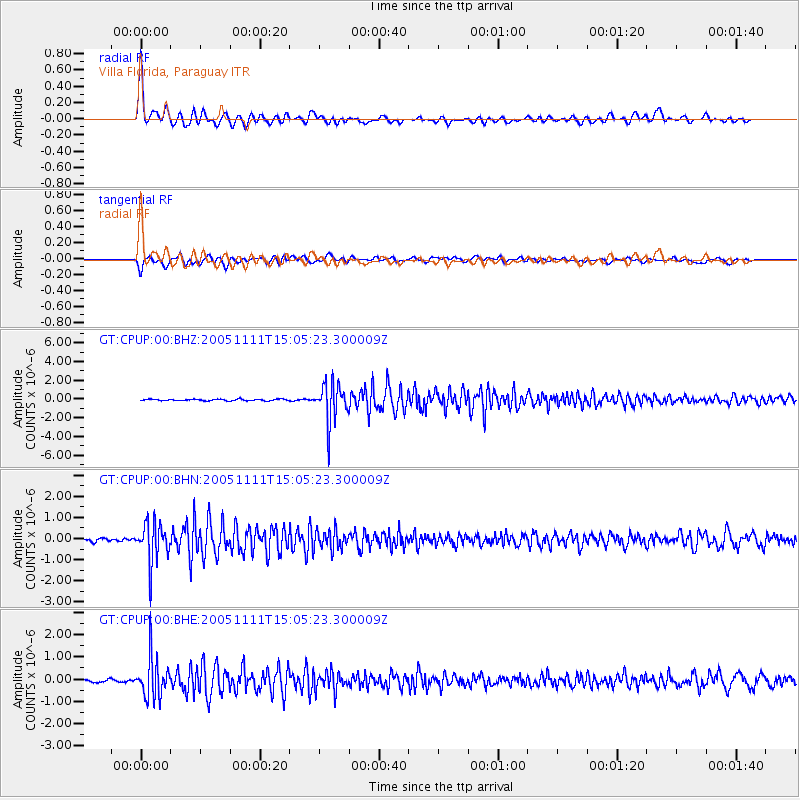
Earthquake location: South Sandwich Islands Region
Earthquake latitude/longitude: -55.7/-27.1
Earthquake time(UTC): 2005/11/11 (315) 14:58:50 GMT
Earthquake Depth: 29 km
Earthquake Magnitude: 5.7 MB, 5.4 MS, 5.9 MW, 5.8 MW
Earthquake Catalog/Contributor: WHDF/NEIC
Network: GT Global Telemetered Seismograph Network (USAF/USGS)
Station: CPUP Villa Florida, Paraguay
Lat/Lon: 26.33 S/57.33 W
Elevation: 105 m
Distance: 36.6 deg
Az: 310.706 deg
Baz: 151.431 deg
Ray Param: 0.07652439
Estimated Moho Depth: 10.0 km
Estimated Crust Vp/Vs: 2.00
Assumed Crust Vp: 6.498 km/s
Estimated Crust Vs: 3.249 km/s
Estimated Crust Poisson's Ratio: 0.33
Radial Match: 95.88388 %
Radial Bump: 400
Transverse Match: 89.89508 %
Transverse Bump: 400
SOD ConfigId: 2422
Insert Time: 2010-02-27 01:51:11.244 +0000
GWidth: 2.5
Max Bumps: 400
Tol: 0.001

Signal To Noise

ChannelStoNSTALTA
GT:CPUP:00:BHN:20051111T15:05:23.300009Z15.8541499.520743E-76.005206E-8
GT:CPUP:00:BHE:20051111T15:05:23.300009Z17.6996949.0886954E-75.134945E-8
GT:CPUP:00:BHZ:20051111T15:05:23.300009Z25.2472172.0555938E-68.1418634E-8
Arrivals
Ps1.6 SECOND
PpPs4.3 SECOND
PsPs/PpSs6.0 SECOND