You are here: Home > Network List > CI - Caltech Regional Seismic Network Stations List
> Station DAN Danby, California, USA > Earthquake Result Viewer
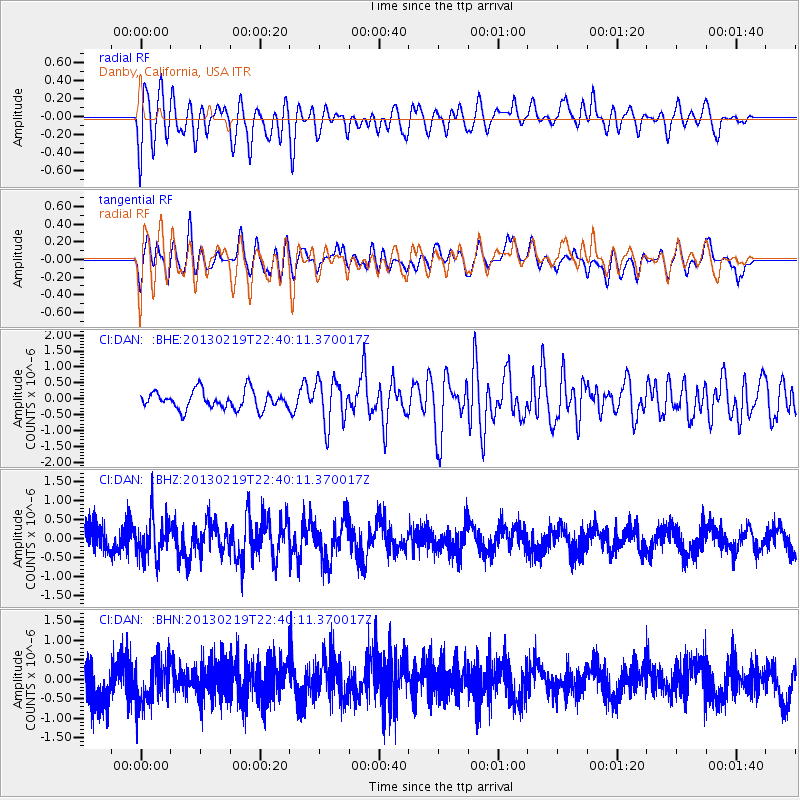
DAN Danby, California, USA - Earthquake Result Viewer
*The percent match for this event was below the threshold and hence no stack was calculated.
| Earthquake location: |
Tonga Islands |
| Earthquake latitude/longitude: |
-17.5/-173.5 |
| Earthquake time(UTC): |
2013/02/19 (050) 22:29:02 GMT |
| Earthquake Depth: |
47 km |
| Earthquake Magnitude: |
5.7 MB, 5.3 MS, 5.7 MW, 5.8 MW |
| Earthquake Catalog/Contributor: |
WHDF/NEIC |
|
| Network: |
CI Caltech Regional Seismic Network |
| Station: |
DAN Danby, California, USA |
| Lat/Lon: |
34.64 N/115.38 W |
| Elevation: |
398 m |
|
| Distance: |
75.7 deg |
| Az: |
46.242 deg |
| Baz: |
236.731 deg |
| Ray Param: |
$rayparam |
*The percent match for this event was below the threshold and hence was not used in the summary stack. |
|
| Radial Match: |
66.22198 % |
| Radial Bump: |
400 |
| Transverse Match: |
60.606365 % |
| Transverse Bump: |
400 |
| SOD ConfigId: |
494114 |
| Insert Time: |
2013-05-09 04:18:05.659 +0000 |
| GWidth: |
2.5 |
| Max Bumps: |
400 |
| Tol: |
0.001 |
|
Signal To Noise
| Channel | StoN | STA | LTA |
| CI:DAN: :BHZ:20130219T22:40:11.370017Z | 1.0520787 | 5.2995165E-7 | 5.037187E-7 |
| CI:DAN: :BHN:20130219T22:40:11.370017Z | 1.0569955 | 5.6741885E-7 | 5.3682237E-7 |
| CI:DAN: :BHE:20130219T22:40:11.370017Z | 2.4956768 | 7.0843356E-7 | 2.8386432E-7 |
| Arrivals |
| Ps | |
| PpPs | |
| PsPs/PpSs | |


