You are here: Home > Network List > IW - Intermountain West Stations List
> Station IMW Indian Meadow, Wyoming, USA > Earthquake Result Viewer
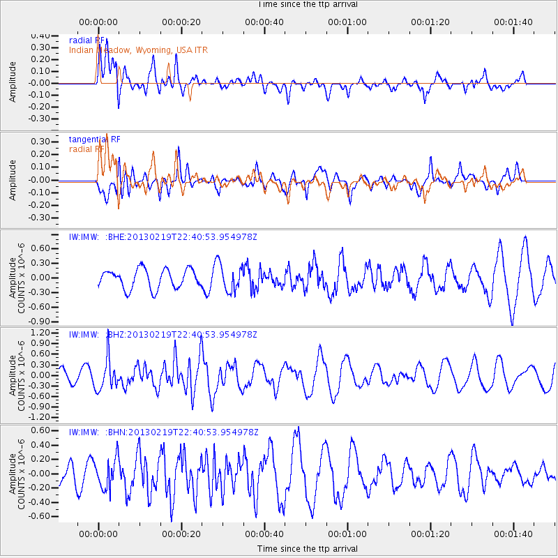
IMW Indian Meadow, Wyoming, USA - Earthquake Result Viewer
*The percent match for this event was below the threshold and hence no stack was calculated.
| Earthquake location: |
Tonga Islands |
| Earthquake latitude/longitude: |
-17.5/-173.5 |
| Earthquake time(UTC): |
2013/02/19 (050) 22:29:02 GMT |
| Earthquake Depth: |
47 km |
| Earthquake Magnitude: |
5.7 MB, 5.3 MS, 5.7 MW, 5.8 MW |
| Earthquake Catalog/Contributor: |
WHDF/NEIC |
|
| Network: |
IW Intermountain West |
| Station: |
IMW Indian Meadow, Wyoming, USA |
| Lat/Lon: |
43.90 N/110.94 W |
| Elevation: |
2646 m |
|
| Distance: |
83.5 deg |
| Az: |
40.195 deg |
| Baz: |
238.446 deg |
| Ray Param: |
$rayparam |
*The percent match for this event was below the threshold and hence was not used in the summary stack. |
|
| Radial Match: |
50.775043 % |
| Radial Bump: |
400 |
| Transverse Match: |
56.311687 % |
| Transverse Bump: |
400 |
| SOD ConfigId: |
494114 |
| Insert Time: |
2013-05-09 04:19:57.890 +0000 |
| GWidth: |
2.5 |
| Max Bumps: |
400 |
| Tol: |
0.001 |
|
Signal To Noise
| Channel | StoN | STA | LTA |
| IW:IMW: :BHZ:20130219T22:40:53.954978Z | 2.3574648 | 4.5408913E-7 | 1.9261756E-7 |
| IW:IMW: :BHN:20130219T22:40:53.954978Z | 0.6626618 | 2.098878E-7 | 3.1673446E-7 |
| IW:IMW: :BHE:20130219T22:40:53.954978Z | 1.2827779 | 2.544105E-7 | 1.9832778E-7 |
| Arrivals |
| Ps | |
| PpPs | |
| PsPs/PpSs | |


