You are here: Home > Network List > TA - USArray Transportable Network (new EarthScope stations) Stations List
> Station V43A Jonesboro, AR, USA > Earthquake Result Viewer
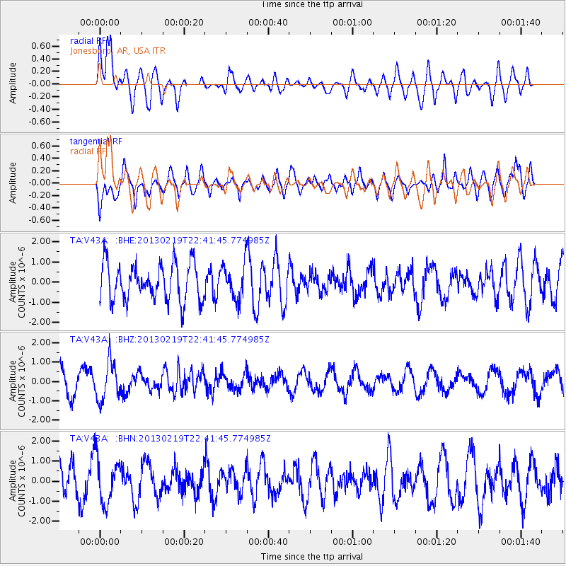
V43A Jonesboro, AR, USA - Earthquake Result Viewer
*The percent match for this event was below the threshold and hence no stack was calculated.
| Earthquake location: |
Tonga Islands |
| Earthquake latitude/longitude: |
-17.5/-173.5 |
| Earthquake time(UTC): |
2013/02/19 (050) 22:29:02 GMT |
| Earthquake Depth: |
47 km |
| Earthquake Magnitude: |
5.7 MB, 5.3 MS, 5.7 MW, 5.8 MW |
| Earthquake Catalog/Contributor: |
WHDF/NEIC |
|
| Network: |
TA USArray Transportable Network (new EarthScope stations) |
| Station: |
V43A Jonesboro, AR, USA |
| Lat/Lon: |
35.79 N/90.54 W |
| Elevation: |
74 m |
|
| Distance: |
94.5 deg |
| Az: |
54.027 deg |
| Baz: |
251.818 deg |
| Ray Param: |
$rayparam |
*The percent match for this event was below the threshold and hence was not used in the summary stack. |
|
| Radial Match: |
57.855682 % |
| Radial Bump: |
400 |
| Transverse Match: |
54.096043 % |
| Transverse Bump: |
400 |
| SOD ConfigId: |
494114 |
| Insert Time: |
2013-05-09 04:22:44.909 +0000 |
| GWidth: |
2.5 |
| Max Bumps: |
400 |
| Tol: |
0.001 |
|
Signal To Noise
| Channel | StoN | STA | LTA |
| TA:V43A: :BHZ:20130219T22:41:45.774985Z | 1.9927143 | 1.0027455E-6 | 5.032059E-7 |
| TA:V43A: :BHN:20130219T22:41:45.774985Z | 1.21632 | 1.0718562E-6 | 8.8122874E-7 |
| TA:V43A: :BHE:20130219T22:41:45.774985Z | 1.0006684 | 9.0270447E-7 | 9.021015E-7 |
| Arrivals |
| Ps | |
| PpPs | |
| PsPs/PpSs | |


