You are here: Home > Network List > CN - Canadian National Seismograph Network Stations List
> Station INK INUVIK, NT > Earthquake Result Viewer
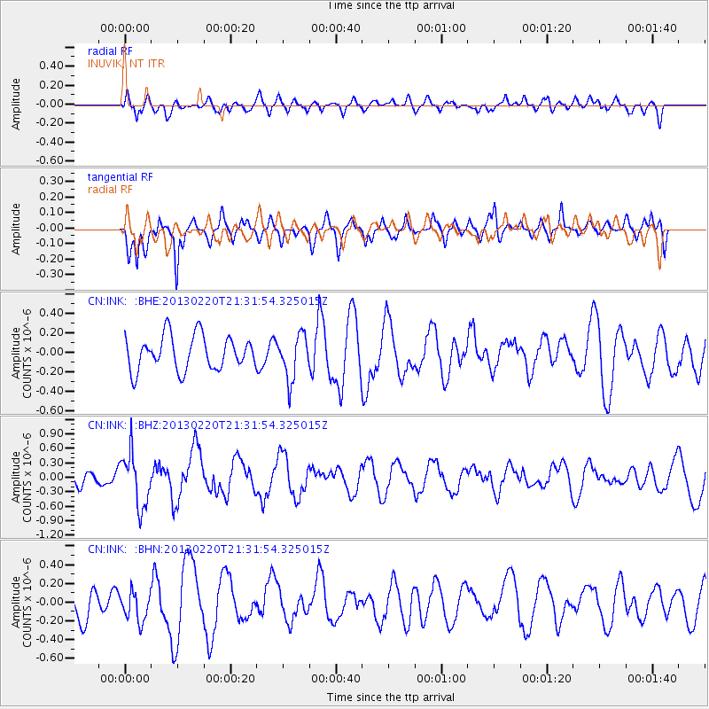
INK INUVIK, NT - Earthquake Result Viewer
*The percent match for this event was below the threshold and hence no stack was calculated.
| Earthquake location: |
Near Coast Of Michoacan, Mexico |
| Earthquake latitude/longitude: |
18.6/-103.7 |
| Earthquake time(UTC): |
2013/02/20 (051) 21:23:08 GMT |
| Earthquake Depth: |
18 km |
| Earthquake Magnitude: |
5.6 MW, 5.1 MS, 5.2 MB, 5.5 MW |
| Earthquake Catalog/Contributor: |
WHDF/NEIC |
|
| Network: |
CN Canadian National Seismograph Network |
| Station: |
INK INUVIK, NT |
| Lat/Lon: |
68.31 N/133.53 W |
| Elevation: |
44 m |
|
| Distance: |
53.2 deg |
| Az: |
346.647 deg |
| Baz: |
143.891 deg |
| Ray Param: |
$rayparam |
*The percent match for this event was below the threshold and hence was not used in the summary stack. |
|
| Radial Match: |
55.524483 % |
| Radial Bump: |
400 |
| Transverse Match: |
71.39181 % |
| Transverse Bump: |
306 |
| SOD ConfigId: |
494114 |
| Insert Time: |
2013-05-09 04:31:07.615 +0000 |
| GWidth: |
2.5 |
| Max Bumps: |
400 |
| Tol: |
0.001 |
|
Signal To Noise
| Channel | StoN | STA | LTA |
| CN:INK: :BHZ:20130220T21:31:54.325015Z | 3.1606138 | 5.574358E-7 | 1.7636947E-7 |
| CN:INK: :BHN:20130220T21:31:54.325015Z | 0.9814556 | 1.595234E-7 | 1.6253756E-7 |
| CN:INK: :BHE:20130220T21:31:54.325015Z | 1.3069297 | 2.2728085E-7 | 1.7390441E-7 |
| Arrivals |
| Ps | |
| PpPs | |
| PsPs/PpSs | |


