You are here: Home > Network List > CI - Caltech Regional Seismic Network Stations List
> Station MPP McPhearson Peak > Earthquake Result Viewer
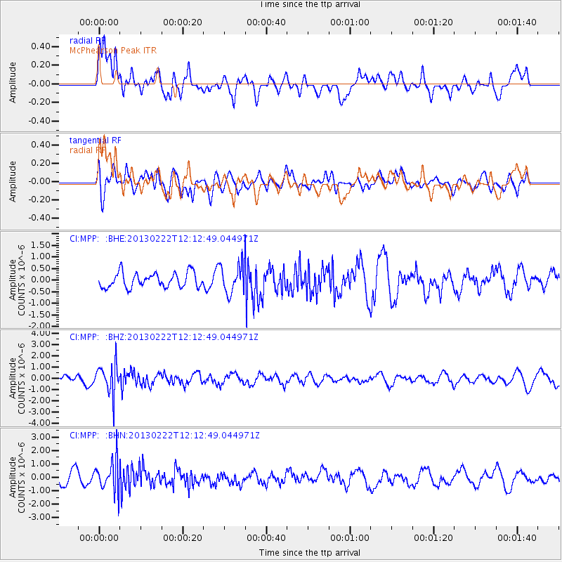
MPP McPhearson Peak - Earthquake Result Viewer
*The percent match for this event was below the threshold and hence no stack was calculated.
| Earthquake location: |
Santiago Del Estero Prov., Arg. |
| Earthquake latitude/longitude: |
-27.9/-63.1 |
| Earthquake time(UTC): |
2013/02/22 (053) 12:01:58 GMT |
| Earthquake Depth: |
575 km |
| Earthquake Magnitude: |
5.8 MB, 6.1 MW, 6.2 MW |
| Earthquake Catalog/Contributor: |
WHDF/NEIC |
|
| Network: |
CI Caltech Regional Seismic Network |
| Station: |
MPP McPhearson Peak |
| Lat/Lon: |
34.89 N/119.81 W |
| Elevation: |
1739 m |
|
| Distance: |
82.3 deg |
| Az: |
316.096 deg |
| Baz: |
131.722 deg |
| Ray Param: |
$rayparam |
*The percent match for this event was below the threshold and hence was not used in the summary stack. |
|
| Radial Match: |
72.013954 % |
| Radial Bump: |
400 |
| Transverse Match: |
59.260452 % |
| Transverse Bump: |
400 |
| SOD ConfigId: |
494114 |
| Insert Time: |
2013-05-09 04:38:18.895 +0000 |
| GWidth: |
2.5 |
| Max Bumps: |
400 |
| Tol: |
0.001 |
|
Signal To Noise
| Channel | StoN | STA | LTA |
| CI:MPP: :BHZ:20130222T12:12:49.044971Z | 3.7248783 | 1.3206111E-6 | 3.5453803E-7 |
| CI:MPP: :BHN:20130222T12:12:49.044971Z | 3.1392138 | 1.1544835E-6 | 3.6776197E-7 |
| CI:MPP: :BHE:20130222T12:12:49.044971Z | 1.9913174 | 6.3652516E-7 | 3.1965027E-7 |
| Arrivals |
| Ps | |
| PpPs | |
| PsPs/PpSs | |


