You are here: Home > Network List > CI - Caltech Regional Seismic Network Stations List
> Station BEL Belle Mtn, Joshua Tree National Park, CA, USA > Earthquake Result Viewer
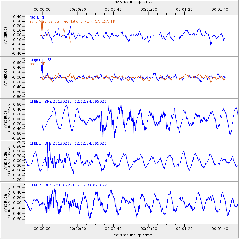
BEL Belle Mtn, Joshua Tree National Park, CA, USA - Earthquake Result Viewer
*The percent match for this event was below the threshold and hence no stack was calculated.
| Earthquake location: |
Santiago Del Estero Prov., Arg. |
| Earthquake latitude/longitude: |
-27.9/-63.1 |
| Earthquake time(UTC): |
2013/02/22 (053) 12:01:58 GMT |
| Earthquake Depth: |
575 km |
| Earthquake Magnitude: |
5.8 MB, 6.1 MW, 6.2 MW |
| Earthquake Catalog/Contributor: |
WHDF/NEIC |
|
| Network: |
CI Caltech Regional Seismic Network |
| Station: |
BEL Belle Mtn, Joshua Tree National Park, CA, USA |
| Lat/Lon: |
34.00 N/116.00 W |
| Elevation: |
1388 m |
|
| Distance: |
79.4 deg |
| Az: |
317.613 deg |
| Baz: |
134.113 deg |
| Ray Param: |
$rayparam |
*The percent match for this event was below the threshold and hence was not used in the summary stack. |
|
| Radial Match: |
55.20138 % |
| Radial Bump: |
400 |
| Transverse Match: |
44.03974 % |
| Transverse Bump: |
400 |
| SOD ConfigId: |
494114 |
| Insert Time: |
2013-05-09 04:38:31.535 +0000 |
| GWidth: |
2.5 |
| Max Bumps: |
400 |
| Tol: |
0.001 |
|
Signal To Noise
| Channel | StoN | STA | LTA |
| CI:BEL: :BHZ:20130222T12:12:34.09502Z | 2.7527459 | 5.132857E-7 | 1.8646318E-7 |
| CI:BEL: :BHN:20130222T12:12:34.09502Z | 1.2542208 | 1.9057447E-7 | 1.519465E-7 |
| CI:BEL: :BHE:20130222T12:12:34.09502Z | 0.8318898 | 2.4950208E-7 | 2.9992202E-7 |
| Arrivals |
| Ps | |
| PpPs | |
| PsPs/PpSs | |


