You are here: Home > Network List > CI - Caltech Regional Seismic Network Stations List
> Station SWS Sam W. Stewart, Westmorland, CA, USA > Earthquake Result Viewer
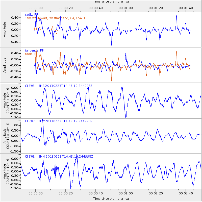
SWS Sam W. Stewart, Westmorland, CA, USA - Earthquake Result Viewer
*The percent match for this event was below the threshold and hence no stack was calculated.
| Earthquake location: |
Santa Cruz Islands |
| Earthquake latitude/longitude: |
-11.7/165.0 |
| Earthquake time(UTC): |
2013/02/23 (054) 14:31:03 GMT |
| Earthquake Depth: |
10 km |
| Earthquake Magnitude: |
5.6 MB, 5.3 MS, 5.6 MW, 5.6 MW |
| Earthquake Catalog/Contributor: |
WHDF/NEIC |
|
| Network: |
CI Caltech Regional Seismic Network |
| Station: |
SWS Sam W. Stewart, Westmorland, CA, USA |
| Lat/Lon: |
32.94 N/115.80 W |
| Elevation: |
140 m |
|
| Distance: |
87.4 deg |
| Az: |
55.772 deg |
| Baz: |
254.392 deg |
| Ray Param: |
$rayparam |
*The percent match for this event was below the threshold and hence was not used in the summary stack. |
|
| Radial Match: |
70.343155 % |
| Radial Bump: |
327 |
| Transverse Match: |
70.696754 % |
| Transverse Bump: |
400 |
| SOD ConfigId: |
494114 |
| Insert Time: |
2013-05-09 05:37:06.061 +0000 |
| GWidth: |
2.5 |
| Max Bumps: |
400 |
| Tol: |
0.001 |
|
Signal To Noise
| Channel | StoN | STA | LTA |
| CI:SWS: :BHZ:20130223T14:43:19.244998Z | 2.3137941 | 5.6955577E-7 | 2.4615662E-7 |
| CI:SWS: :BHN:20130223T14:43:19.244998Z | 0.7561117 | 3.3017602E-7 | 4.3667623E-7 |
| CI:SWS: :BHE:20130223T14:43:19.244998Z | 1.3428468 | 5.585376E-7 | 4.1593546E-7 |
| Arrivals |
| Ps | |
| PpPs | |
| PsPs/PpSs | |


