DBIC Dimbokro, Cote d'Ivoire - Earthquake Result Viewer
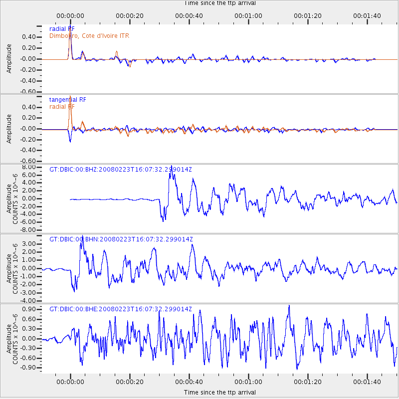
Earthquake location: South Sandwich Islands Region
Earthquake latitude/longitude: -57.3/-23.4
Earthquake time(UTC): 2008/02/23 (054) 15:57:19 GMT
Earthquake Depth: 10 km
Earthquake Magnitude: 6.2 MB, 6.7 MS, 6.7 MW, 6.7 MW
Earthquake Catalog/Contributor: WHDF/NEIC
Network: GT Global Telemetered Seismograph Network (USAF/USGS)
Station: DBIC Dimbokro, Cote d'Ivoire
Lat/Lon: 6.67 N/4.86 W
Elevation: 125 m
Distance: 65.6 deg
Az: 20.328 deg
Baz: 190.935 deg
Ray Param: 0.058195606
Estimated Moho Depth: 38.75 km
Estimated Crust Vp/Vs: 1.66
Assumed Crust Vp: 6.419 km/s
Estimated Crust Vs: 3.861 km/s
Estimated Crust Poisson's Ratio: 0.22
Radial Match: 97.48783 %
Radial Bump: 302
Transverse Match: 91.805214 %
Transverse Bump: 400
SOD ConfigId: 2564
Insert Time: 2010-02-27 01:52:57.282 +0000
GWidth: 2.5
Max Bumps: 400
Tol: 0.001

Signal To Noise

ChannelStoNSTALTA
GT:DBIC:00:BHN:20080223T16:07:32.299014Z24.3326322.006034E-68.2442135E-8
GT:DBIC:00:BHE:20080223T16:07:32.299014Z5.3481093.4360002E-76.424702E-8
GT:DBIC:00:BHZ:20080223T16:07:32.299014Z47.7679864.287482E-68.97564E-8
Arrivals
Ps4.2 SECOND
PpPs15 SECOND
PsPs/PpSs20 SECOND